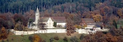
Kloster Lorch, Benedictine monastery in Lorch, Baden-Württemberg, Germany
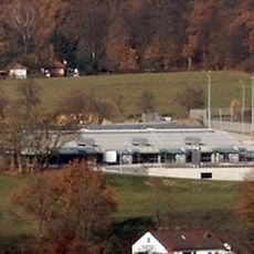
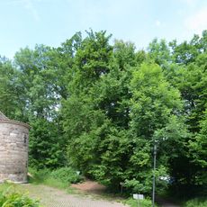
Kloster Lorch is a Benedictine monastery at the narrowest point of the Rems Valley, featuring a Romanesque basilica with a central nave and a preserved round structure. The buildings cluster together and define the valley with their stone facades and distinctive window openings.
The monastery was founded in 1102 as a burial place for the Staufer family and a center for learning. Over centuries it became an important religious and cultural site in the region.
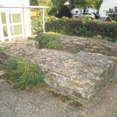
The monastery has a historical garden displaying medieval plants and traditional layouts. The site shows how Benedictine monks lived and worked within these walls for centuries.
The site can be visited from Wednesday to Sunday, with opening times from 11 AM to 6 PM during warmer months. During colder seasons expect reduced hours.
The monastery holds a tomb of the Staufer family with surprising international connections, including the resting place of a daughter of a Byzantine emperor. This family burial chamber reveals links to distant powers and dynasties.
Location: Lorch
Inception: 1102
Founders: Frederick I, Duke of Swabia
Fee: Yes
Address: Klosterstraße
Opening Hours: Monday-Sunday 10:00-17:00
Phone: +497172928497
Website: https://kloster-lorch.com
GPS coordinates: 48.79885,9.70329
Latest update: December 7, 2025 19:32
Castra of Lorch
1.1 km
Barbarossa-Linde
136 m
Schillerhaus (Lorch)
1.2 km
Evangelische Stadtkirche Lorch
1.1 km
9 Wellingtonien
966 m
Limeswachturm Wp 12/14
206 m
Forchengruppe und Alte Göppinger Straße
1.4 km
Lorcher Baggerseen
2.8 km
Aimersbachtal
2.2 km
Hauptschule Auf dem Schäfersfeld
525 m
Götzenbachtal
1.5 km
Eberhardt-Ludwig-Stein
1.3 km
Feuchtgebiet im Schweizerbachtal
1.6 km
1 Eiche beim Signal Pferchgarten
302 m
Silberweide im Gewann Gairen, Lorch, Württemberg
2.2 km
Sporthalle Auf dem Schäfersfeld
370 m
Baumbestand am Klostereingang
102 m
1 Eiche am Eberrainweg
1.6 km
ND Eichenrain auf der Vorderen Halde, Lorch
652 m
1 Hoflinde beim Ziegelhof
570 m
1 Linde im Staffelgehren
1 km
Vogelschutzgehölz Tobel
2.4 km
Eichenwäldchen beim Römerturm
513 m
Eichenallee im Schweizerbachtal
1.7 km
Ehemaliger Steinbruch nördl.Hollenhof
879 m
Auwaldgebiet links der Rems
735 m
Auefläche an der Rems
1.8 km
Progymnasium Auf dem Schäfersfeld
431 mVisited this place? Tap the stars to rate it and share your experience / photos with the community! Try now! You can cancel it anytime.
Discover hidden gems everywhere you go!
From secret cafés to breathtaking viewpoints, skip the crowded tourist spots and find places that match your style. Our app makes it easy with voice search, smart filtering, route optimization, and insider tips from travelers worldwide. Download now for the complete mobile experience.
A unique approach to discovering new places❞
— Le Figaro
All the places worth exploring❞
— France Info
A tailor-made excursion in just a few clicks❞
— 20 Minutes