Heidenwall, Medieval ring fort in Oldenburg, Germany
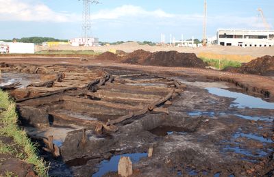
Heidenwall is a medieval ring fortress near Oldenburg with a circular defensive structure made of wooden foundations and earthen walls about 54 meters across. The structure rises from the ground like a natural mound, showing the typical defense design of this early period.
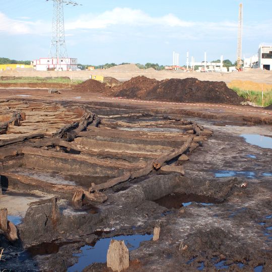
Archaeological excavations in 2007 revealed that the fortress dates back to 1032, with additional fortifications added around 1042 during a second building phase. These two construction phases suggest a repeated need to reinforce and improve the defensive installation.
The name Heidenwall emerged when later generations in the region forgot the fortress's original purpose and function. Today the name preserves a vague memory of pagan times, though its exact meaning has long been obscured.
The wall's remains lie in eastern Oldenburg, between a commercial estate, the Hemmelsbäker Kanal and the Hunte; nothing is visible above ground, so the site is not a destination for a walk. The area is low, formerly marshy terrain, and the outlines were once traced from crop marks in the vegetation. The location is best understood together with old maps such as Musculus's dyke atlas of 1625/26.
The site was long thought destroyed by canal and dike works and was left off the Lower Saxony register of cultural monuments. The historian Martin Teller located it using old maps and aerial photographs, where crop marks traced the ring. When a 29-hectare industrial estate was planned in 2006, he alerted the state heritage office, leading to a rescue excavation in May 2007.
The community of curious travelers
AroundUs brings together thousands of curated places, local tips, and hidden gems, enriched daily by 93,571 contributors worldwide.