Hochhädrich, Mountain summit in Allgäu Alps, Austria and Germany
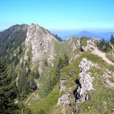
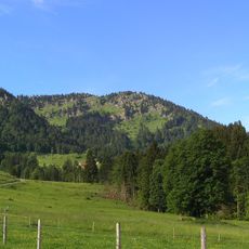
Hochhädrich is a mountain peak in the Allgäu Alps that rises between Vorarlberg and Bavaria. The slopes are covered with green alpine meadows crisscrossed by marked hiking routes of varying difficulty.
The mountain was first recorded in 1471 as Harderich. Its name derives from the collective form "Hart" for brushwood or pasture, not from the surname Hädrich. The summit, at 1566 m, lies on the German-Austrian border and is the westernmost peak of the Hochgrat chain in the Nagelfluhkette nature park.
The name Hochhäderich derives from the collective form "Hart" for brushwood or pasture, not from the surname Hädrich; the mountain was first recorded in 1471 as Harderich. Older maps often spell it Hochhädrich without the second e, and local pronunciation makes no distinction between the two forms.
Hikers can reach the summit from several starting points, with trails offering different lengths and requirements. Mountain huts along the routes provide resting spots and food options during the climb.
From the summit area, visitors can see into both countries and experience the different landscapes of Austria and Germany from one spot. This border location offers a rare advantage for hikers wanting to explore two regions at once.
The community of curious travelers
AroundUs brings together thousands of curated places, local tips, and hidden gems, enriched daily by 93,757 contributors worldwide.