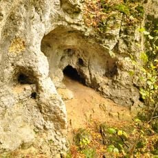
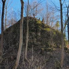
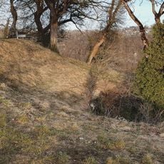
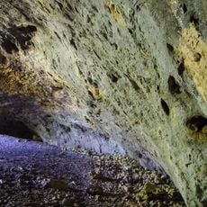
Schertelshöhle, Show cave in Westerheim, Germany.
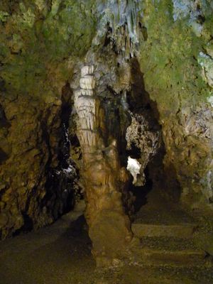
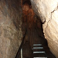
The Schertelshöhle is a show cave in the Swabian Alb with two sections: a lit main wing for visitors and a separate unexplored side passage. The main area displays various limestone formations that developed naturally over time within the cave system.
The cave was already known in 1470 as Schretzenloch and was used differently over time: first as a disposal site for livestock and later as a beer cellar. These changes show how people adapted the cave to fit their needs.
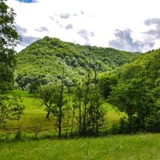
The cave name reflects old local traditions and shows how the region has connected with this underground space over centuries. Visitors can observe how limestone naturally forms here and understand the role such places hold in the Swabian Alb.
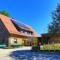
Visits are possible from Palm Sunday through mid-November, with guided tours lasting about half an hour. Parking is located a short distance from the cave entrance, making it convenient for visitors to reach the site.
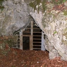
The cave contains a hidden side passage about 50 meters long that ends in an unexplored dead end, preserving a sense of adventure for curious visitors. This unreachable section remains a mystery and reminds visitors that not every part of the cave is accessible.
Location: Westerheim
Accessibility: Wheelchair inaccessible
Website: https://schertelshoehle.de
GPS coordinates: 48.53489,9.58768
Latest update: December 13, 2025 12:40
Reussenstein Castle
3.3 km
Gutenberger Höhle
4.9 km
Neidlinger Wasserfall
3.2 km
Gußmannshöhle
5.1 km
Mondmilchhöhle
5.2 km
Ruine Sperberseck
5.1 km
Römerstein
4.3 km
Wolfsschluchthöhle
5.1 km
Oberes Lenninger Tal mit Seitentälern
5.7 km
Ruine Hohengutenberg
5.1 km
St. Cyriakus (Wiesensteig)
4.1 km
Naturschutzzentrum Schopflocher Alb
4.5 km
Ruine Wuelstein
5.2 km
Unter dem Burz
5.3 km
Steinbruch Lauster
4.6 km
Römerstein Tower
4.2 km
Sommerschafweide hinter dem Hockenden Stein, Auchtweide
2.6 km
LSG 'Neidlinger Tal' vom18.12.1975
4.7 km
Oberes Filstal - Stadt Wiesensteig
3.3 km
LSG 'Landschaftsbestandteile und Landschaftsteile im Landkreis Nürtingen' vom 22.10.1942
4 km
Protestant Church
4.9 km
Reußenstein
3.3 km
Steinernes Haus
184 m
Neidlinger Wasserfall und Fließgewässer im Gewann Pfanne
3.2 km
Donntal
5.5 km
3 Linden vor der Kirche
2.8 km
Filsaue unterhalb kleiner Filsursprung
2.3 km
Westerheim
2.8 kmVisited this place? Tap the stars to rate it and share your experience / photos with the community! Try now! You can cancel it anytime.
Discover hidden gems everywhere you go!
From secret cafés to breathtaking viewpoints, skip the crowded tourist spots and find places that match your style. Our app makes it easy with voice search, smart filtering, route optimization, and insider tips from travelers worldwide. Download now for the complete mobile experience.
A unique approach to discovering new places❞
— Le Figaro
All the places worth exploring❞
— France Info
A tailor-made excursion in just a few clicks❞
— 20 Minutes