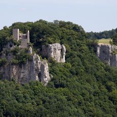
Römerstein, Mountain summit in Baden-Württemberg, Germany.
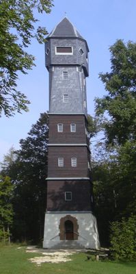
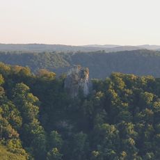
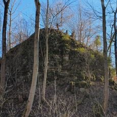
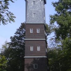
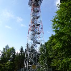
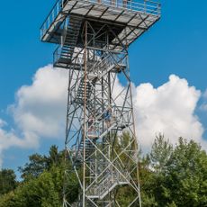
The Römerstein is a mountain in Baden-Württemberg that rises 872 meters above sea level and features a forested summit with a notable observation tower. This 28-meter-high structure was built in 1912 and offers an excellent vantage point over the region.
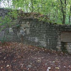
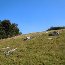
In ancient times, Roman settlements developed near Donnstetten between 85 and 260 AD. The mountain itself was later named after the Rem family, who shaped the area during the Middle Ages.
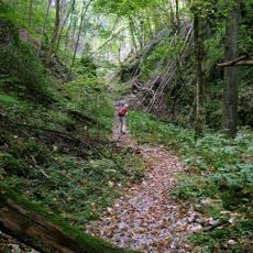
The name comes from the Rem family, who lived in this area during the Middle Ages. Hikers encounter traditional Swabian mountain culture here, which continues to be maintained by local hiking clubs.
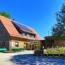
The observation tower opens during warmer months on weekends and holidays, with barbecue areas and playgrounds available for families. The hiking trails to the summit are well-marked, with the area remaining accessible throughout the year.
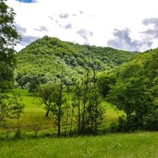
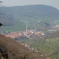
From the tower platform, visitors see the Lauter valley, the peaks of the Filstal, and the alpine landscape of the Swabian Alps in broad perspective. On clear days, the view spans multiple valleys and shows the variety of local landforms.
Location: Baden-Württemberg
Elevation above the sea: 872 m
GPS coordinates: 48.51024,9.54361
Latest update: December 14, 2025 15:01
Reussenstein Castle
6 km
Gutenberger Höhle
3.9 km
Neidlinger Wasserfall
5.6 km
Ruine Wielandstein
5.9 km
Schertelshöhle
4.3 km
Gußmannshöhle
4 km
Mondmilchhöhle
2.1 km
Ruine Sperberseck
2 km
Wolfsschluchthöhle
4.1 km
Oberes Lenninger Tal mit Seitentälern
3.1 km
Ruine Hohengutenberg
3.4 km
Naturschutzzentrum Schopflocher Alb
4.6 km
Ruine Wuelstein
3.7 km
Steinbruch Lauster
4.6 km
Römerstein Tower
18 m
Hursch-Tower
4.5 km
Sommerschafweide hinter dem Hockenden Stein, Auchtweide
2.3 km
Waldgreut Tower
4.7 km
LSG 'Landschaftsbestandteile und Landschaftsteile im Landkreis Nürtingen' vom 22.10.1942
3.9 km
Reußenstein
5.9 km
LSG 'Albtrauf Oberlenningen' vom 16.05.1973
5.6 km
Steinernes Haus
4.1 km
Donntal
2.3 km
Donntal - Lange Steige
3.2 km
3 Linden vor der Kirche
1.7 km
Zaininger Hüle mit Baumbestand
3.2 km
Neidlinger Wasserfall und Fließgewässer im Gewann Pfanne
5.6 km
Westerheim
5 kmVisited this place? Tap the stars to rate it and share your experience / photos with the community! Try now! You can cancel it anytime.
Discover hidden gems everywhere you go!
From secret cafés to breathtaking viewpoints, skip the crowded tourist spots and find places that match your style. Our app makes it easy with voice search, smart filtering, route optimization, and insider tips from travelers worldwide. Download now for the complete mobile experience.
A unique approach to discovering new places❞
— Le Figaro
All the places worth exploring❞
— France Info
A tailor-made excursion in just a few clicks❞
— 20 Minutes