Enable Location

We need your location to show you interesting places around you

Discover nearby places

Find interesting locations and hidden gems around you

Precise directions

Get accurate directions and distances to places

Your location is never shared with other users. It's only used when you tap the location button.

Talsperre Schömbach

Log in to your account

Start exploring — it's free

Trusted by 62,372 travelers worldwide

Continue with Google
Continue with Apple
or

We will send you a code to connect

By continuing, you accept our Terms and Conditions and our Privacy Policy

Check your inbox

We've sent a pincode in your inbox. Please enter the code below.

Talsperre Schömbach

Talsperre Schömbach, reservoir in Germany

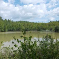
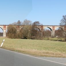
The Talsperre Schömbach is a dam on the border between Saxony and Thuringia, built from a sand embankment with an asphalt seal. The structure, roughly 750 meters long, holds back water from the Wiera and Leuba rivers and can store over 6 million cubic meters of water.

The dam was built between 1967 and 1972 as a flood control measure and to regulate water flow in the region. In the 1990s, it underwent major repairs to fix cracks and replace the asphalt layer.

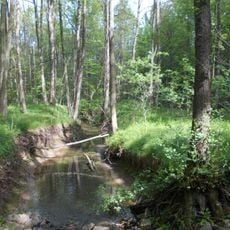
The dam takes its name from the nearby village of Schömbach, which lost some farms during its construction. Today it stands as a place where locals and visitors experience how human structures and natural surroundings coexist in daily life.

You can walk on the dam itself and enjoy views of the water and surrounding landscape from above. At the west end there is an observation point where you can see the structure and the water spread below.

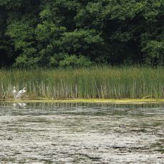
The dam is part of a larger flood protection system that shields the city of Leipzig, comprising several dams and channels working together. While swimming and boating are prohibited to preserve the natural shorelines, anglers can fish from the banks and benefit from plentiful fish stocks.

The community of curious travelers

AroundUs brings together thousands of curated places, local tips, and hidden gems, enriched daily by 60,000 contributors worldwide.

Start exploring
Location
GPS coordinates
50.99110,12.57030
Latest update
February 9, 2026 08:23
Around this place
Gnandstein Castle
Germany

Gnandstein Castle

3.1 km
Kohren Castle
Germany

Kohren Castle

3.8 km
Leinawald
Germany

Leinawald

2.3 km
Halbes Schloss
Germany

Halbes Schloss

3.6 km
Schwind-Pavillon, Rüdigsdorf
Germany

Schwind-Pavillon, Rüdigsdorf

3.1 km
Dorfkirche Gnandstein
Germany

Dorfkirche Gnandstein

2.8 km
St.-Gangolf Church
Germany

St.-Gangolf Church

3.9 km
St. Nikolai (Langenleuba-Niederhain)
Germany

St. Nikolai (Langenleuba-Niederhain)

4 km
Saint Catherine Church
Germany

Saint Catherine Church

2.4 km
Protestant Church
Germany

Protestant Church

4.5 km
Protestant Church Bocka (Windischleuba)
Germany

Protestant Church Bocka (Windischleuba)

3.8 km
Sachgesamtheit Friedhof Gnandstein, mit den Einzeldenkmalen: Leichenhalle und Friedhofstor (siehe Einzeldenkmalliste - Obj. 08970759) sowie mit dem Sachgesamtheitsteil: Einfriedungsmauer sowie gärtnerisch gestaltete Friedhofsanlage (Gartendenkmal)
Germany

Sachgesamtheit Friedhof Gnandstein, mit den Einzeldenkmalen: Leichenhalle und Friedhofstor (siehe Einzeldenkmalliste - Obj. 08970759) sowie mit dem Sachgesamtheitsteil: Einfriedungsmauer sowie gärtnerisch gestaltete Friedhofsanlage (Gartendenkmal)

2.4 km
Lindigtmühle
Germany

Lindigtmühle

3.1 km
Burg Gnandstein
Germany

Burg Gnandstein

3 km
Pastholz Langenleuba
Germany

Pastholz Langenleuba

5.1 km
Leinawald
Germany

Leinawald

2.1 km
Rathaus (bestehend aus zwei Gebäudeteilen) Markt 68
Germany

Rathaus (bestehend aus zwei Gebäudeteilen) Markt 68

3.9 km
Töpferbrunnen
Germany

Töpferbrunnen

3.9 km
Kohrener Land
Germany

Kohrener Land

3.3 km
Station 119 Sahlis
Germany

Station 119 Sahlis

3.6 km
War memorial Neuenmörbitz
Germany

War memorial Neuenmörbitz

2.4 km
Viadukt Wiesebach
Germany

Viadukt Wiesebach

4.8 km
Pfarrhof mit Pfarrhaus, Scheune, Toranlage, Hofpflasterung und Resten der Ummauerung Gnandsteiner Hauptstraße 1
Germany

Pfarrhof mit Pfarrhaus, Scheune, Toranlage, Hofpflasterung und Resten der Ummauerung Gnandsteiner Hauptstraße 1

2.8 km
Kohren-Sahlis Pottery Museum
Germany

Kohren-Sahlis Pottery Museum

3.7 km
Einzeldenkmale der Sachgesamtheit Friedhof Gnandstein: Leichenhalle und Friedhofstor (siehe auch Sachgesamtheitsliste - Obj. 09304490)
Germany

Einzeldenkmale der Sachgesamtheit Friedhof Gnandstein: Leichenhalle und Friedhofstor (siehe auch Sachgesamtheitsliste - Obj. 09304490)

2.4 km
Kriegerdenkmal für die Gefallenen des 1. Weltkrieges Gnandsteiner Hauptstraße 1 (neben)
Germany

Kriegerdenkmal für die Gefallenen des 1. Weltkrieges Gnandsteiner Hauptstraße 1 (neben)

2.8 km
Kurfürstlich-Sächsischer Wegestein
Germany

Kurfürstlich-Sächsischer Wegestein

380 m
Wohnhaus (Umgebinde) Hinterdorfstraße 5
Germany

Wohnhaus (Umgebinde) Hinterdorfstraße 5

3.2 km
Show the full map
« Talsperre Schömbach - reservoir in Germany » is provided by Around Us (aroundus.com). Images and texts are derived from Wikimedia project under a Creative Commons license. You are allowed to copy, distribute, and modify copies of this page, under the conditions set by the license, as long as this note is clearly visible.

Discover hidden gems everywhere you go!

From secret cafés to breathtaking viewpoints, skip the crowded tourist spots and find places that match your style. Our app makes it easy with voice search, smart filtering, route optimization, and insider tips from travelers worldwide. Download now for the complete mobile experience.

Around Us App Screenshot

A unique approach to discovering new places

Le Figaro

All the places worth exploring

France Info

A tailor-made excursion in just a few clicks

20 Minutes

Around Us
Travel Guide & Maps
Download

Send to your phone

QR Code
1

Open the camera app on your mobile.

2

Point at the QR code with your camera. A notification will appear.

3

Tap the notification to open the link.