Chest opened
+${chestReward.xp} XP
Explorer
NOUVEAU ×${chestReward.collectible.quantity}
tapez pour fermer

See the monuments around you in AR Open chests in the app

Around Us is built for your phone — point your camera at the streets and discover the monuments and places around you in augmented reality. Around Us is built for your phone — chests unlock when you walk, explore and capture nearby places.

•

Enable Location

We need your location to show you interesting places around you

Discover nearby places

Find interesting locations and hidden gems around you

Precise directions

Get accurate directions and distances to places

Your location is never shared with other users. It's only used when you tap the location button.

Teufelstisch

Log in to your account

Start exploring — it's free

Trusted by 94,049 travelers worldwide

Continue with Google
Continue with Apple
or

We will send you a code to connect

By continuing, you accept our Terms and Conditions and our Privacy Policy

Check your inbox

We've sent a pincode in your inbox. Please enter the code below.

Teufelstisch

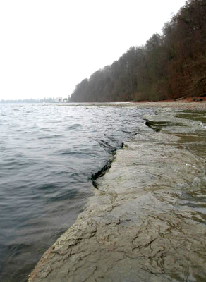
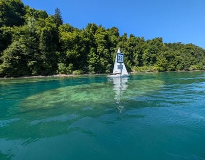
Teufelstisch, Rock formation in Lake Constance, Germany.

The Teufelstisch is a rock formation in Lake Constance with a flat plateau measuring roughly 22 by 10 meters. This plateau normally sits about 1.5 meters below the water surface and features steep walls that drop away sharply on all sides.

Diving at the Teufelstisch was restricted after fatal accidents in 1977 (four deaths), 1979 (two), 1991 (one) and 1993 (two), and was banned outright in 1994. Only experienced divers with an exceptional permit may still dive there; a further death was recorded in April 2011 at 61 metres.

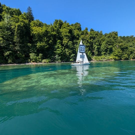
This rock formation serves as a navigation marker for boats crossing Lake Constance and carries the reference number 22 on nautical charts. Locals and sailors recognize it as part of the lake's natural landmarks that guide daily water traffic.

From the shore, the rock is visible from the Bodensee-Rundweg between Wallhausen and the Marienschlucht, about one kilometre northwest of Wallhausen, on the right; look for the back of marker 22 and the pale water over the elliptical shallows. The plateau lies 50 metres from the bank and only breaks the surface at very low water, below 2.30 metres.

The rock is not fully detached: a narrow rock bridge called the Sattel links it to the Bodanrück base at a depth of about 32 metres, so only slightly more than 30 metres of the pinnacle stand free. The plateau, roughly 22 by 10 metres, has broken the surface only in reported low-water years such as 1823, 1949, 1963, 1972 and 2006.

The community of curious travelers

AroundUs brings together thousands of curated places, local tips, and hidden gems, enriched daily by 94,049 contributors worldwide.
Start exploring
GPS coordinates
47.75379,9.12515
Latest update
October 30, 2026 23:11
Reviews
Share your experience

No review yet

Discussions
Start a discussion...

No discussion yet

« Teufelstisch - Rock formation in Lake Constance, Germany » is provided by Around Us (aroundus.com). Images and texts are derived from Wikimedia project under a Creative Commons license. You are allowed to copy, distribute, and modify copies of this page, under the conditions set by the license, as long as this note is clearly visible.

Discover hidden gems everywhere you go!

From secret cafés to breathtaking viewpoints, skip the crowded tourist spots and find places that match your style. Our app makes it easy with voice search, smart filtering, route optimization, and insider tips from travelers worldwide. Download now for the complete mobile experience.

Around Us App Screenshot
❝

A unique approach to discovering new places❞

— Le Figaro

❝

All the places worth exploring❞

— France Info

❝

A tailor-made excursion in just a few clicks❞

— 20 Minutes

Around Us
Travel Guide & Maps
Download

Send to your phone

QR Code
1

Open the camera app on your mobile.

2

Point at the QR code with your camera. A notification will appear.

3

Tap the notification to open the link.