Sperenberger Gipsbrüche, Protected geological site in Am Mellensee, Germany.
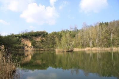
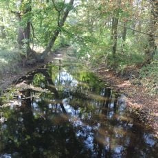
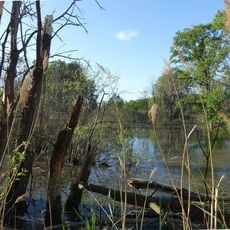
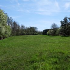
The Sperenberger Gipsbrüche is a protected site with four lakes that formed in old quarry pits, surrounded by steep rock walls on protected land. The edges of these lakes are covered with natural vegetation and create a space where water and stone meet.
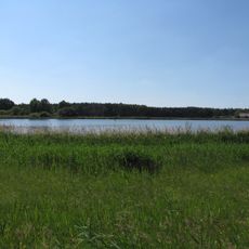
The area was mined for gypsum from the 12th century until 1958, with a groundbreaking deep drilling operation between 1867 and 1871. This work left behind the lakes we see today and transformed a flat region into a varied landscape.
The name comes from the gypsum extraction that shaped the landscape for centuries and remains visible today. You can read this heritage in the structure of the land, where natural lakes and rock walls tell the story of past work.
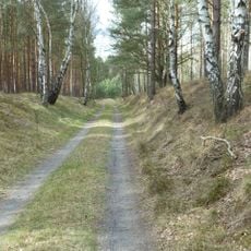
A walking trail from the village leads around all four lakes and lets you explore the entire area. The ground can be wet in places, so wear proper shoes and allow enough time to walk the full route.
The site contains Brandenburg's only natural sinkhole and special habitats for European otters, greater mouse-eared bats, and kingfishers. These rare animal species have adapted to the unique conditions created by the former mining landscape.
Location: Am Mellensee
Inception: March 13, 1998
GPS coordinates: 52.13724,13.38154
Latest update: December 14, 2025 11:22
Heeresversuchsanstalt Kummersdorf
6.9 km
Historisch-Technisches Museum – Versuchsstelle Kummersdorf
4.3 km
Kloster Alexanderdorf
3.9 km
Scheunenmühle Saalow
6.4 km
Gutshaus Neuhof
6.8 km
Village church Sperenberg
1.1 km
Gipsberg
506 m
Sperenberg railway station
1.6 km
Dorfkirche Wünsdorf
5.8 km
Gutshaus Sperenberg
990 m
Lazarettfriedhof Saalow
6.1 km
Paltrockmühle Saalow
5.9 km
Schöbendorfer Busch
7.6 km
Kummersdorfer Heide/Breiter Steinbusch
3.7 km
Forsthaus Wunder
6.4 km
Mönninghausen
2.5 km
Village church Schönefeld, Nuthe Urstromtal
7.5 km
House of the Officers
7.6 km
Trompeterhaus (Horstwalde)
7.5 km
Schmelze (Horstwalde)
6.4 km
Landschaftsschutzgebiet Baruther Urstromtal und Luckenwalder Heide
6.5 km
Wünsdorf, Seestraße 19
6.4 km
Schöbendorfer Busch
7.1 km
Nuthe, Hammerfließ und Eiserbach
6.3 km
Gipsberg Observation Tower
493 m
Wehrdamm/Mellensee/Kleiner Wünsdorfer See
6.5 km
Wasserturm Rehagen
3 km
Naturdenkmal Linde (Baum) Dorfplatz; Flur 3, Flurstück 27 in Gadsdorf
6.9 kmVisited this place? Tap the stars to rate it and share your experience / photos with the community! Try now! You can cancel it anytime.
Discover hidden gems everywhere you go!
From secret cafés to breathtaking viewpoints, skip the crowded tourist spots and find places that match your style. Our app makes it easy with voice search, smart filtering, route optimization, and insider tips from travelers worldwide. Download now for the complete mobile experience.
A unique approach to discovering new places❞
— Le Figaro
All the places worth exploring❞
— France Info
A tailor-made excursion in just a few clicks❞
— 20 Minutes