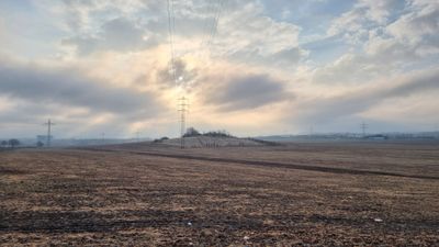
Gamighübel, hill in Germany
Gamighübel is a small hill made of granodiorite that rises just under 200 meters above sea level, marked by its rocky surface with patches of grass and shrubs. The structure shows different layers of stone containing visible fossils of marine creatures from the Cretaceous period, embedded in cracks and hollows throughout the rock face.
Gamighübel was used as a stone quarry in the 1800s, with workers from nearby villages extracting granodiorite for road construction. During these quarrying activities, workers discovered numerous fossils of marine creatures from the Cenomanian period about 100 million years ago, leading later scientists to study the ancient seabed that once covered the region.
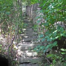
Gamighübel carries a name of Slavic origin meaning stone, first recorded in 1592. Today visitors use the hill as a quiet place for walking and observing nature, moving slowly across its open meadows and rocky slopes to experience the landscape without rush or noise.
The hill is easily reached via well-marked walking paths with solid ground underfoot, making it accessible to most visitors without special equipment. The best time to visit is during dry seasons when the paths are clear and weather conditions are favorable for outdoor walking.
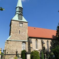
An old local legend tells of dwarves said to have mined gold and precious stones inside the hill, with their hammer strikes audible on quiet days. According to the tale, these dwarves supposedly moved their treasures across the nearby Elbe river to another location after a church was built nearby and its bells began to ring.
Location: Dresden
GPS coordinates: 51.00105,13.76856
Latest update: December 19, 2025 08:44
Kirche Leubnitz-Neuostra
1.3 km
Kreisgrabenanlage Dresden-Nickern
1.2 km
Schloss Nickern
1.5 km
Kirche Prohlis
1.8 km
Talsperre Kauscha
1.4 km
Heimat- und Palitzschmuseum Prohlis
1.9 km
Naturdenkmal Stieleiche Kauscha
1.2 km
Rathaus Leubnitz-Neuostra
1.3 km
Pyrus communis in Friebestraße, Dresden-Gostritz
1.5 km
Palitzschbrunnen
1.8 km
Gedenkstein für Bombenopfer des 13. Februar 1945
1.5 km
Ziegeleigruben Prohlis und Torna
1.7 km
Palitzsch Memorial
1.9 km
Stolperstein dedicated to Fritz Meinhardt
1.6 km
Brücke über den Geberbach Goppeln
1.7 km
Zeitungsleser
1.7 km
Zwei Wohnstallhäuser (über winkelförmigem Grundriss), Scheune, Hofmauer mit Toreinfahrt und zwei Pforten sowie Stützmauern der Vorgärten eines Vierseithofes, ehemals wohl Vorwerk Goppelner Hauptstraße 1
1.3 km
Ehemalige Schule Golberoder Straße 4
1.4 km
Wohnstallhaus eines Bauernhofes und Toranlage (zwei Torpfeiler und Pforte) Dorfstraße 18
1.5 km
Spitzwegstraße 67a
1.7 km
Wohnstallhaus (über Hakengrundriss), Scheune und Torpfeiler eines Bauernhofes Goppelner Hauptstraße 7
1.4 km
Portal eines Bauernhofes Dorfstraße 27
1.6 km
Wohnstallhaus (Dorfstraße 20/20a), ehem. Scheune (Goppelner Hauptstraße 9) und Seitengebäude sowie Torpfeiler eines Bauernhofes Dorfstraße 20; 20a
1.5 km
Wohnstallhaus (Nr. 12, auf Hakengrundriss), Seitengebäude (Nr. 10) und Toranlage (Torbogen und Pforte) eines Bauernhofes Dorfstraße 10; 12
1.5 km
Golberoder Mühle Golberode
1.9 km
Weinberghäuschen, Weinberg, Einfriedungsmauer und Treppe Golberoder Straße 17 (hinter)
1.5 km
Wohnstallhaus, Scheune, Stallgebäude und Toranlage (Torbogen und Pforte) eines Dreiseithofes Dorfstraße 16
1.5 kmVisited this place? Tap the stars to rate it and share your experience / photos with the community! Try now! You can cancel it anytime.
Discover hidden gems everywhere you go!
From secret cafés to breathtaking viewpoints, skip the crowded tourist spots and find places that match your style. Our app makes it easy with voice search, smart filtering, route optimization, and insider tips from travelers worldwide. Download now for the complete mobile experience.
A unique approach to discovering new places❞
— Le Figaro
All the places worth exploring❞
— France Info
A tailor-made excursion in just a few clicks❞
— 20 Minutes