
Kirchhof, Kirchhof, Grabmale bis 1870, Feldsteinwall, Kastanienkranz
Location: Siek
Address: Kirchenweg
GPS coordinates: 53.63413,10.29694
Latest update: March 3, 2025 10:23


Braaker Mühle
5 km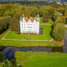
Ahrensburg Castle
6.3 km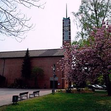
Church of Resurrection
2.9 km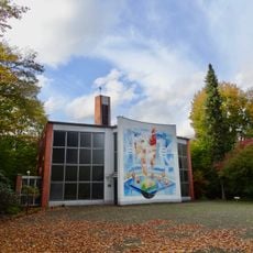
Church of Holy Spirit
2.2 km
Burg Arnesvelde
5 km
Stellmoor-Ahrensburger Tunneltal
5.6 km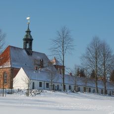
Palace church Ahrensburg
6.1 km
Gottesbuden, Ahrensburg
6.1 km
Moorgebiet Kranika
6.3 km
Friedenskirche Siek
25 m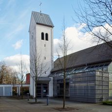
St. Marienkirche in Ahrensburg
5.9 km
Hoisdorfer Teiche
2.8 km
Marstall am Schloss Ahrensburg
6.3 km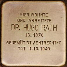
Stolperstein dedicated to Hugo Rath
5.5 km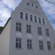
Gebäude der Stormarnschule
5.4 km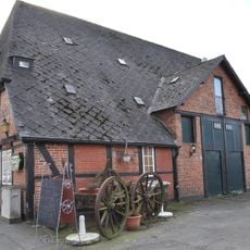
Bei der Alten Kate 6
6 km
Gottesbuden (Nordtrakt)
6.2 km
Freie evangelische Gemeinde Ahrensburg
6.3 km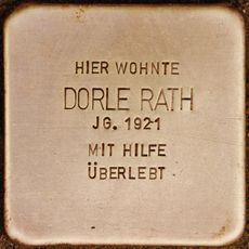
Stolperstein dedicated to Dorle Rath
5.5 km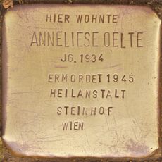
Stolperstein dedicated to Anneliese Oelte
5.1 km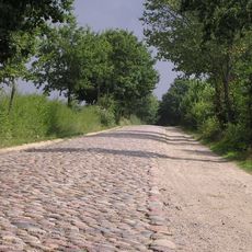
Pflasterstraße mit Sommerweg
3.6 km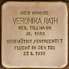
Stolperstein dedicated to Veronika Rath
5.5 km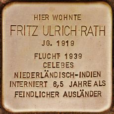
Stolperstein dedicated to Fritz Ulrich Rath
5.5 km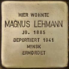
Stolperstein dedicated to Magnus Lehmann
5.8 km
Höltigbaum
6 km
Schloss Ahrensburg: Verwalterhaus
6.3 km
Rauchkate
6.1 km
Gottesbuden (Südtrakt)
6.1 kmReviews
Visited this place? Tap the stars to rate it and share your experience / photos with the community! Try now! You can cancel it anytime.
Discover hidden gems everywhere you go!
From secret cafés to breathtaking viewpoints, skip the crowded tourist spots and find places that match your style. Our app makes it easy with voice search, smart filtering, route optimization, and insider tips from travelers worldwide. Download now for the complete mobile experience.

A unique approach to discovering new places❞
— Le Figaro
All the places worth exploring❞
— France Info
A tailor-made excursion in just a few clicks❞
— 20 Minutes