Chest opened
+${chestReward.xp} XP
Explorer
NOUVEAU ×${chestReward.collectible.quantity}
tapez pour fermer

See the monuments around you in AR Open chests in the app

Around Us is built for your phone — point your camera at the streets and discover the monuments and places around you in augmented reality. Around Us is built for your phone — chests unlock when you walk, explore and capture nearby places.

•

Enable Location

We need your location to show you interesting places around you

Discover nearby places

Find interesting locations and hidden gems around you

Precise directions

Get accurate directions and distances to places

Your location is never shared with other users. It's only used when you tap the location button.

Saufang-Weiher

Log in to your account

Start exploring — it's free

Trusted by 93,044 travelers worldwide

Continue with Google
Continue with Apple
or

We will send you a code to connect

By continuing, you accept our Terms and Conditions and our Privacy Policy

Check your inbox

We've sent a pincode in your inbox. Please enter the code below.

Saufang-Weiher, protected area in Germany

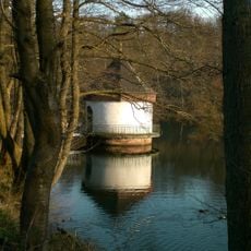
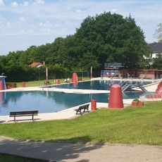
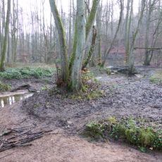
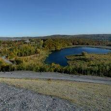
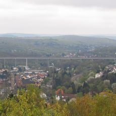
The Saufang-Weiher is a pond in the Bildstock district of Friedrichsthal, west of the town centre and near the A8 motorway. It has no natural inflow or outflow and was created in 1957 as a settling basin for the Maybach mine. A circular walking trail runs around the water, and a forest playground for children stands nearby.

The pond was created in 1957 as a settling basin for the nearby Maybach coal mine operated by Saarbergwerke AG. After the mine closed in 1964, the site fell into neglect until a local fishing club began restoring it in 1971 and continues to care for it today.

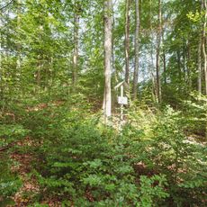
The Anglersportverein Bildstock, founded in 1971, built the fishing hut at the pond and still runs fishing there. The club's members turned the silted basin into a local recreation area. Since 2014, 13 information boards along the water describe the local flora and fauna.

The walking trail is barrier-free and allows wheelchair users easy access to the observation platform by the water. There is free parking in Friedrichsthal-Bildstock close to the pond, with seating areas and grilling spots available on site for visitors.

The area was not originally created as a natural pond but emerged from industrial history as a settling basin for mining operations. This unexpected origin shows how industrial spaces can transform into nature refuges and today gain a second life as part of the 'Landscapes of Industrial Culture North' project.

The community of curious travelers

AroundUs brings together thousands of curated places, local tips, and hidden gems, enriched daily by 93,044 contributors worldwide.

Start exploring
Location
Inception
1990
GPS coordinates
49.32560,7.07909
Latest update
October 25, 2026 17:49
Reviews
Share your experience

No review yet

Discussions
Start a discussion...

No discussion yet

« Saufang-Weiher - protected area in Germany » is provided by Around Us (aroundus.com). Images and texts are derived from Wikimedia project under a Creative Commons license. You are allowed to copy, distribute, and modify copies of this page, under the conditions set by the license, as long as this note is clearly visible.

Discover hidden gems everywhere you go!

From secret cafés to breathtaking viewpoints, skip the crowded tourist spots and find places that match your style. Our app makes it easy with voice search, smart filtering, route optimization, and insider tips from travelers worldwide. Download now for the complete mobile experience.
Around Us App Screenshot
❝

A unique approach to discovering new places❞

— Le Figaro

❝

All the places worth exploring❞

— France Info

❝

A tailor-made excursion in just a few clicks❞

— 20 Minutes

Around Us
Travel Guide & Maps
Download

Send to your phone

QR Code
1

Open the camera app on your mobile.

2

Point at the QR code with your camera. A notification will appear.

3

Tap the notification to open the link.