Grand Crêt d'Eau, Mountain summit in the French Jura range, France.
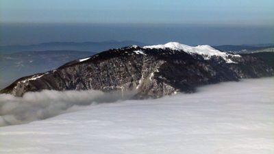
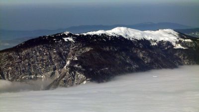
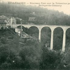
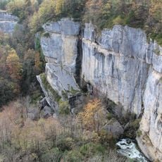
Grand Crêt d'Eau is a mountain summit in the French Jura with a height of 1,621 meters and forms a limestone ridge rising above the Valserine Valley. The area is characterized by extensive high pastures that spread gently across the plateau.
The region has been shaped by grazing since centuries, when early inhabitants cleared forests to create pasture lands. This livestock farming molded the landscape and led to the establishment of mountain operations like the Varambon dairy in the early 1800s.
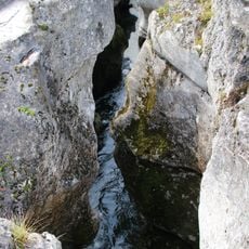
The name comes from the springs and water holes scattered across the landscape, which have long supported shepherds in their work. These natural water sources continue to shape the appearance of the high pasture and reflect the deep connection between people and the land.
The main routes start from Lancrans and require good fitness for a full day outing. Visitors should bring sturdy boots, plenty of water, and protective clothing, as conditions vary with the season.
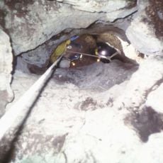
Natural water holes locally called goyas form through limestone erosion and serve livestock as vital water sources during summer months. These geological features are rare and make the area of interest for nature observers.
Location: Valserhône
Location: Confort
Location: Farges
Location: Collonges
Location: Léaz
Elevation above the sea: 1,621 m
GPS coordinates: 46.15049,5.86380
Latest update: December 13, 2025 17:03
Fort l'Écluse
4 km
Pont des Pierres
4.4 km
Carnot bridge
4.6 km
Pertes de la Valserine
4.5 km
Viaduc de Longeray
4.6 km
Gouffre de la Rasse
1.9 km
Viaduc de Bellegarde
5 km
Col de Menthières
3.5 kmRéserve naturelle régionale de la galerie du pont des pierres
4.4 km
Saint Brice
3.9 km
Église de l'Immaculée-Conception de Confort
3.1 km
Église Saint-Théodule de Collonges
3.3 km
Église Saint-Jean-Baptiste de Châtillon-en-Michaille
5 km
Église Saint-Amand de Lancrans
3.7 km
Town hall of Montanges
5.1 km
War memorial of Confort
3.2 km
Town hall of Farges
3.7 km
Gorges de la Valserine
4.4 km
Chapelle Notre-Dame-des-Grâces de Lancrans
3.8 km
War memorial of Collonges
3.4 km
War memorial of Farges
3.9 km
War memorial of Lancrans
3.7 km
Town hall of Confort
3.2 km
Mairie de Collonges
3.4 km
Croix du Crêt de la Goutte
12 m
Town hall of Lancrans
3.7 km
War memorial of Montanges
5.1 km
War memorial of Châtillon-de-Michaille
5.1 kmVisited this place? Tap the stars to rate it and share your experience / photos with the community! Try now! You can cancel it anytime.
Discover hidden gems everywhere you go!
From secret cafés to breathtaking viewpoints, skip the crowded tourist spots and find places that match your style. Our app makes it easy with voice search, smart filtering, route optimization, and insider tips from travelers worldwide. Download now for the complete mobile experience.
A unique approach to discovering new places❞
— Le Figaro
All the places worth exploring❞
— France Info
A tailor-made excursion in just a few clicks❞
— 20 Minutes