Enable Location

We need your location to show you interesting places around you

Discover nearby places

Find interesting locations and hidden gems around you

Precise directions

Get accurate directions and distances to places

Your location is never shared with other users. It's only used when you tap the location button.

Belfort

Log in to your account

Start exploring — it's free

Trusted by 63,540 travelers worldwide

Continue with Google
Continue with Apple
or

We will send you a code to connect

By continuing, you accept our Terms and Conditions and our Privacy Policy

Check your inbox

We've sent a pincode in your inbox. Please enter the code below.

Discussion Reviews 3 Photos
155k Popularity

Belfort, Administrative division in Bourgogne-Franche-Comté, France

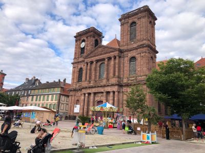
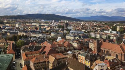
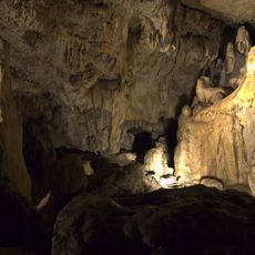
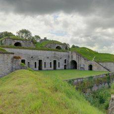
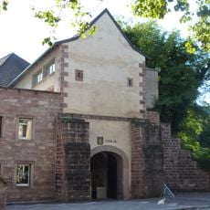
Belfort is a town in northeastern France nestled between the Vosges mountains and the Swiss border. The 17th-century citadel rises above the old town and provides sweeping views over the surrounding plain and hills.

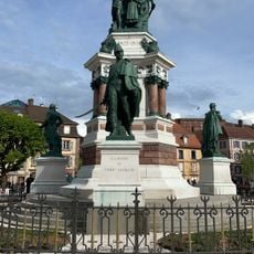
The town remained French after the Franco-Prussian War, while Alsace-Lorraine was ceded to Germany. The territory gained status as a standalone department in 1922.

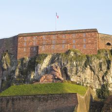
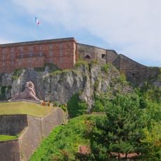
The red sandstone lion was carved between 1875 and 1880 by Frédéric Auguste Bartholdi and commemorates the defense of the town during the siege from 1870 to 1871. This monumental lion measures 22 meters (72 feet) in length and 11 meters (36 feet) in height, dominating the hillside beneath the citadel.

The citadel sits on a hill above the old town and can be reached through several paths and staircases. Visitor centers and orientation panels are located at the base of the climb and around the main square.

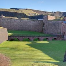
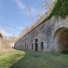
The citadel was designed by Vauban, the famed military architect of Louis XIV, and served for centuries as a frontier fortress against Habsburg territories. Its star-shaped outer walls remain largely intact today and are open for walks.

The community of curious travelers

AroundUs brings together thousands of curated places, local tips, and hidden gems, enriched daily by 60,000 contributors worldwide.

Start exploring
Elevation above the sea
414 m
Shares border with
Bavilliers, Cravanche, Danjoutin, Denney, Essert, Évette-Salbert, Offemont, Pérouse, Valdoie
Address
Belfort, France
Phone
GPS coordinates
47.63750,6.86278
Latest update
December 14, 2025 21:22
Reviews
Share your experience

No review yet

Discussions
Start a discussion...

No discussion yet

« Belfort - Administrative division in Bourgogne-Franche-Comté, France » is provided by Around Us (aroundus.com). Images and texts are derived from Wikimedia project under a Creative Commons license. You are allowed to copy, distribute, and modify copies of this page, under the conditions set by the license, as long as this note is clearly visible.

Discover hidden gems everywhere you go!

From secret cafés to breathtaking viewpoints, skip the crowded tourist spots and find places that match your style. Our app makes it easy with voice search, smart filtering, route optimization, and insider tips from travelers worldwide. Download now for the complete mobile experience.

Around Us App Screenshot

A unique approach to discovering new places

Le Figaro

All the places worth exploring

France Info

A tailor-made excursion in just a few clicks

20 Minutes

Around Us
Travel Guide & Maps
Download

Send to your phone

QR Code
1

Open the camera app on your mobile.

2

Point at the QR code with your camera. A notification will appear.

3

Tap the notification to open the link.