Saint-Omer

Log in to your account

AroundUs is a community-driven map of interesting places, built by curious explorers like you. It grows with every review, story, and photo you share.
Connect to save your favorite spots, contribute locations, and create personalized routes.
Continue with Google
Continue with Apple
Continue with X
Continue with Facebook
Continue with email
By continuing, you accept our Terms and Conditions and our Privacy Policy
Create an account
Add to collection
Map
Suggest a change
Share

Saint-Omer, Administrative commune in northern Pas-de-Calais, France.

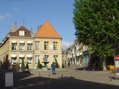
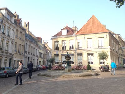
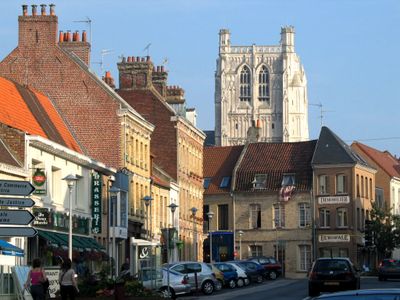
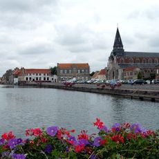
Saint-Omer is a town in northern France that sits along the Aa River and the Canal de Neufossé. The center features a network of historic streets, churches with distinctive architecture, and waterways that shape the townscape.

The town grew around the Abbey of Saint-Bertin in the 7th century and gained official city status in 1127. Over the centuries it expanded through trade and became an important regional center due to its strategic location.

The old town with its canals and merchant houses reflects the prosperity of past trading eras. Today, shops, cafes, and local markets bring these historic streets to life, drawing daily foot traffic from residents and visitors.

The town is easy to explore on foot and has clear, easy-to-navigate streets in the center. Visitors find shops, restaurants, and public squares throughout, making it simple to discover the place in a single day.

The town library holds one of only three French copies of the Gutenberg Bible, one of the oldest printed works. The collection was recently enriched with a rare Shakespeare folio, adding to its extraordinary holdings.

Location: Pas-de-Calais

Location: arrondissement of Saint-Omer

Elevation above the sea: 4 m

Shares border with: Tilques, Nieurlet, Saint-Momelin, Arques, Clairmarais, Longuenesse, Saint-Martin-lez-Tatinghem, Salperwick, Serques

Address: Saint-Omer, France

Phone: +33321984088

Email: service-administres@ville-saint-omer.fr

Website: https://ville-saint-omer.fr

GPS coordinates: 50.74833,2.26083

Latest update: December 17, 2025 09:07

Photos
Pilgrimages in Europe: spiritual routes, sanctuaries and places of devotion

Pilgrimage routes in Europe have been crossing the continent for centuries. They lead travelers to quiet places for reflection and prayer. Medieval paths like the Camino de San Salvador cross mountains and connect cathedrals in Spain. The Via Francigena goes from Canterbury to Rome, passing through...

Reviews

Visited this place? Tap the stars to rate it and share your experience / photos with the community! Try now! You can cancel it anytime.

« Saint-Omer - Administrative commune in northern Pas-de-Calais, France » is provided by Around Us (aroundus.com). Images and texts are derived from Wikimedia project under a Creative Commons license. You are allowed to copy, distribute, and modify copies of this page, under the conditions set by the license, as long as this note is clearly visible.

Discover hidden gems everywhere you go!

From secret cafés to breathtaking viewpoints, skip the crowded tourist spots and find places that match your style. Our app makes it easy with voice search, smart filtering, route optimization, and insider tips from travelers worldwide. Download now for the complete mobile experience.

Around Us App Screenshot

A unique approach to discovering new places

Le Figaro

All the places worth exploring

France Info

A tailor-made excursion in just a few clicks

20 Minutes