Rochefourchat, Small commune in the Drôme department, France.
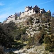
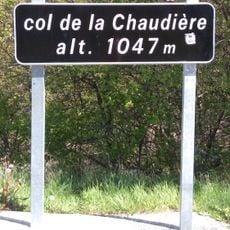
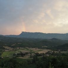
Rochefourchat is a mountain commune situated at an elevation of 1006 meters in the Drôme department of southeastern France, covering an area of approximately 12.74 square kilometers with varied terrain ranging from 600 to 1513 meters in altitude.
The village has maintained its traditional rural character throughout the centuries, with population records showing a gradual decline from six inhabitants in 1968 to just one permanent resident recorded in recent official censuses.
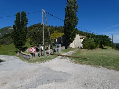
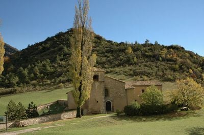
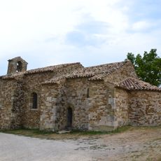
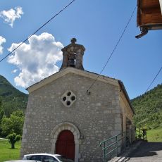
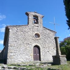
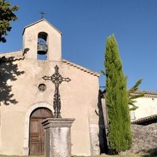
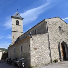
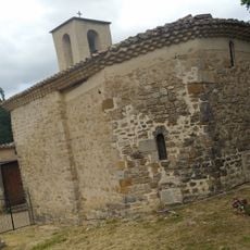
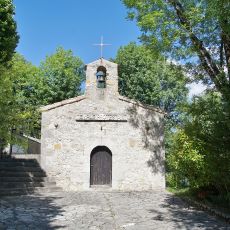
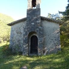
Rochefourchat preserves traditional Provençal rural customs with its Saint Pierre church serving as the central community landmark, along with stone houses and narrow streets typical of mountain settlements in this region of France.
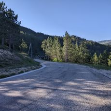
The commune is accessible via country roads with postal code 26340, and the nearest significant town is Die located about 20 kilometers to the northeast, while the village maintains a town hall with limited opening hours on Friday mornings.
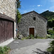
Rochefourchat is recognized as one of the least populated communes in France, with only one permanent resident while maintaining seven dwellings that serve primarily as secondary residences or occasional accommodations for visitors seeking rural solitude.
Location: canton of La Motte-Chalancon
Location: Drôme
Location: arrondissement of Die
Elevation above the sea: 1,006 m
Shares border with: Pradelle, La Chaudière, Saint-Nazaire-le-Désert, Les Tonils
Address: 26340 Rochefourchat, France
Phone: +33475272601
Email: mairie.rochefourchat@gmail.com
GPS coordinates: 44.59861,5.24722
Latest update: November 25, 2025 20:59
France has some municipalities with extremely low populations, not exceeding 12 residents. These villages reflect the demographic shifts in rural France and provide insight into a lifestyle that has become rare. Rochefourchat in Drôme holds the record with just one inhabitant, while Aingoulaincourt...
Chapelle Saint-Jean de Crupies
7.8 km
Réserve naturelle régionale de la grotte des Sadoux
3.5 km
Église de Saint-Benoit-en-Diois
7.4 km
Temple de Bourdeaux
9.1 km
Chapelle du cimetière de Savel
6.9 km
Église Saint-Pierre-ès-Liens de Pradelle
3.7 km
Temple méthodiste appelé La Chapelle à Bourdeaux
9.1 km
Église de La Chaudière
4.4 km
Église Notre-Dame de Gumiane
10.2 km
Église de Bourdeaux
9.1 km
Église Saint-Pierre de Rochefourchat
65 m
Église Notre-Dame-de-la-Nativité de Volvent
8.8 km
Église Saint-Antoine de Bouvières
9.5 km
Église de Montréal-les-Sources
10.9 km
Temple d'Orcinas
10.4 km
Église Saint-Nazaire-et-Saint-Celse de Saint-Nazaire-le-Désert
3.9 km
Col de la Chaudière
4.8 km
Chapelle Saint-Moirans de Chastel-Arnaud
6.8 km
Chapelle Saint-Joseph de Saint-Nazaire-le-Désert
4 km
Col Lescou
10.1 km
Temple de Pennes-le-Sec
7.1 km
Chapelle Notre-Dame de l'Aribat
1.3 km
War memorial of Bouvières
9.5 km
War memorial of Gumiane
10.2 km
Maison du 15e siècle
9.2 km
Temple de Mornans
9.9 km
Col de Tavard
4.5 km
Les Trois Becs
5.7 kmVisited this place? Tap the stars to rate it and share your experience / photos with the community! Try now! You can cancel it anytime.
Discover hidden gems everywhere you go!
From secret cafés to breathtaking viewpoints, skip the crowded tourist spots and find places that match your style. Our app makes it easy with voice search, smart filtering, route optimization, and insider tips from travelers worldwide. Download now for the complete mobile experience.
A unique approach to discovering new places❞
— Le Figaro
All the places worth exploring❞
— France Info
A tailor-made excursion in just a few clicks❞
— 20 Minutes