Pont de la Concorde

Log in to your account

AroundUs is a community-driven map of interesting places, built by curious explorers like you. It grows with every review, story, and photo you share.
Connect to save your favorite spots, contribute locations, and create personalized routes.
Continue with Google
Continue with Apple
Continue with X
Continue with Facebook
Continue with email
By continuing, you accept our Terms and Conditions and our Privacy Policy
Create an account
Add to collection
Map
Suggest a change
Share

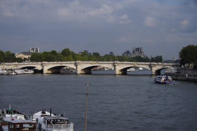
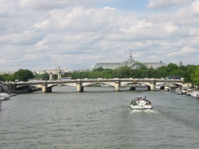
Pont de la Concorde, Stone arch bridge near Place de la Concorde, France

The Pont de la Concorde is a stone arch bridge crossing the Seine, linking the main plaza with the National Assembly building. The structure features multiple elegant arches and stretches across the river with substantial width to handle the flow of people and vehicles.

Construction began in 1787 and finished in 1791, during the French Revolution period, with materials including stones salvaged from the demolished Bastille. The structure was substantially widened decades later to accommodate the city's growing traffic needs.

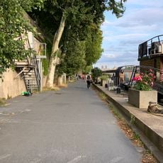
The bridge's name references the grand square it meets, symbolizing the revolutionary vision of reconciliation and harmony. Visitors can observe how locals and tourists naturally flow across this passage, connecting the grandeur of one bank with the institutional power of the other.

The bridge is easily accessible on foot from both riverbanks and provides a natural crossing between the city's main attractions and government district. Be aware that this is a heavily trafficked route, especially during peak hours and warmer months.

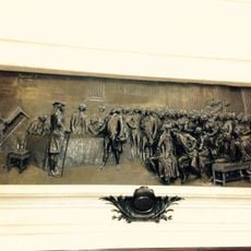
Stones from the demolished Bastille were incorporated into the bridge's foundations, literally embedding the symbol of the revolution into the new structure. This fusion of destruction and renewal makes the crossing itself a physical reminder of that tumultuous era.

Location: 7th arrondissement of Paris

Location: 8th arrondissement of Paris

Location: Quartier des Champs-Élysées

Location: Invalides

Inception: 1787

Architects: Jean-Rodolphe Perronet

Official opening: 1791

Length: 153 m

Width: 34 m

Made from material: stone

Part of: road network of Paris

Shares border with: place de la Concorde, boulevard Saint-Germain, quai d'Orsay, cours la Reine, Quai des Tuileries

GPS coordinates: 48.86333,2.31944

Latest update: December 7, 2025 20:47

Photos
Reviews

Visited this place? Tap the stars to rate it and share your experience / photos with the community! Try now! You can cancel it anytime.

« Pont de la Concorde - Stone arch bridge near Place de la Concorde, France » is provided by Around Us (aroundus.com). Images and texts are derived from Wikimedia project under a Creative Commons license. You are allowed to copy, distribute, and modify copies of this page, under the conditions set by the license, as long as this note is clearly visible.

Discover hidden gems everywhere you go!

From secret cafés to breathtaking viewpoints, skip the crowded tourist spots and find places that match your style. Our app makes it easy with voice search, smart filtering, route optimization, and insider tips from travelers worldwide. Download now for the complete mobile experience.

Around Us App Screenshot

A unique approach to discovering new places

Le Figaro

All the places worth exploring

France Info

A tailor-made excursion in just a few clicks

20 Minutes