Meschers-sur-Gironde, Coastal village in Charente-Maritime, France
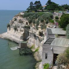
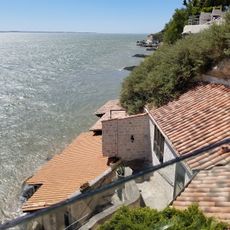
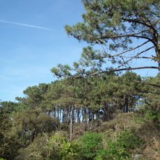
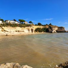
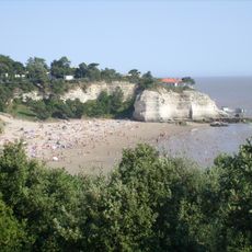
Meschers-sur-Gironde sits along the Gironde estuary with limestone cliffs that rise roughly 30 meters above the water and sandy beaches below. The settlement spreads along this coastline with homes built into the natural landscape.
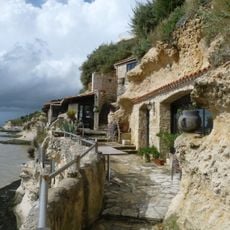
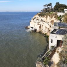
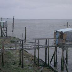
The settlement began as a fishing village and gradually transformed into a residential community with permanent structures. The caves carved into the cliff face show how people adapted their homes to the terrain over time.
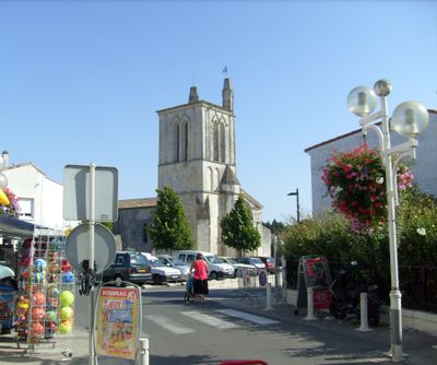
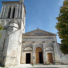
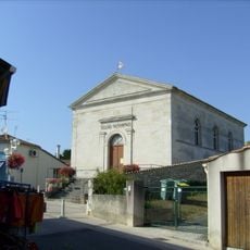
The Saint-Saturnin church anchors the village center and shows how local religious buildings shape community life. You can see the architectural style that reflects the region's traditions.
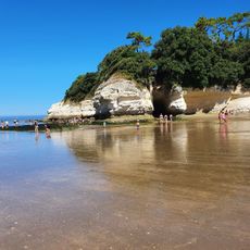
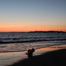
Three main beaches—Nonnes, Vergnes, and Arnèche—offer direct water access, each staffed with seasonal lifeguards during peak times. The coastal road connects these areas, making exploration on foot or by car straightforward.
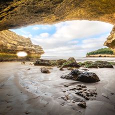
The Régulus and Matata caves carved into the limestone contain multiple chambers that served as homes until the twentieth century. These underground rooms show an unusual way people adapted to living along the coast.
Location: canton of Cozes
Location: Charente-Maritime
Location: Arrondissement of Rochefort
Elevation above the sea: 10 m
Shares border with: Arces, Saint-Georges-de-Didonne, Semussac, Le Verdon-sur-Mer, Soulac-sur-Mer, Talais
Address: Meschers-sur-Gironde, France
Phone: +33546397100
Email: mairie@meschers.fr
Website: http://meschers.com
GPS coordinates: 45.55750,-0.95389
Latest update: December 22, 2025 23:55
Grottes de Matata
406 m
Grottes de Régulus
406 m
Grottes de Matata
349 m
Forêt de Suzac
3.4 km
Église Saint-Saturnin de Meschers-sur-Gironde
144 m
Grottes du Régulus
387 mDolmen de Beauregard
3.1 km
Plage des Vergnes
1.7 km
Conche de Cadet
745 m
Plage de Suzac
2.9 km
Scenic viewpoint
658 m
Plage de l'Arnèche
2.1 km
Plage des Nonnes
1 km
Temple de l'église protestante unie de France de Meschers-sur-Gironde
281 mScenic viewpoint
2.4 kmScenic viewpoint
2 kmScenic viewpoint
948 mScenic viewpoint
836 mScenic viewpoint
425 mScenic viewpoint
2.4 kmND de Lourdes
1 kmPlage des Vergnes
1.7 kmWayside cross
716 mTomb
1.5 kmDolmen de Beloire
3.1 kmCommemorative plaque, memorial
524 mWayside cross
324 mWayside cross
1.5 kmVisited this place? Tap the stars to rate it and share your experience / photos with the community! Try now! You can cancel it anytime.
Discover hidden gems everywhere you go!
From secret cafés to breathtaking viewpoints, skip the crowded tourist spots and find places that match your style. Our app makes it easy with voice search, smart filtering, route optimization, and insider tips from travelers worldwide. Download now for the complete mobile experience.
A unique approach to discovering new places❞
— Le Figaro
All the places worth exploring❞
— France Info
A tailor-made excursion in just a few clicks❞
— 20 Minutes