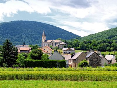
Pierre-Châtel, commune in Isère, France
Location: canton of La Mure
Location: Isère
Location: arrondissement of Grenoble
Elevation above the sea: 970 m
Shares border with: Saint-Théoffrey, Susville, Villard-Saint-Christophe, La Motte-d'Aveillans, La Mure, Saint-Honoré
Address: Place Henri-et-Marthe-Gaillard, 38119 Pierre-Châtel 38119
Phone: +33476830637
Email: contact@pierre-chatel.fr
Website: http://pierre-chatel.fr
GPS coordinates: 44.95694,5.77611
Latest update: June 4, 2025 02:34
Lac de Monteynard-Avignonet
6.9 km
Chemin de Fer de La Mure
5 km
Barrage de Monteynard
6.9 km
Pierre Percée
1.6 km
Le Tabor
6.6 km
Viaduc de la Roizonne
6.3 km
Le Grand Serre
6.7 km
La Mine image
2.7 km
Château d'Ars
7.8 km
Sénépy
6.9 km
Montagne du Conest
5.6 km
Puits de Rioux
6.9 km
Puits du Villaret
3.6 km
Château de Beaumont
5.9 km
Musée Matheysin
6 km
Arboretum de Combe Noire
1.2 km
Eglise Saint-Pierre (La Valette)
6.5 km
Equestrian statue of Napoleon
6.8 km
Église de Laffrey
7.5 km
Église Saint-Laurent de Notre-Dame-de-Vaulx
4.2 km
Église Saint-Pierre de La Motte-d'Aveillans
2.4 km
Viaduc de la Clapisse
6.5 km
Église de l'Assomption de La Mure
5.8 km
Église de l'Assomption-de-la-Sainte-Vierge de Cholonge
5.4 km
Église Saint-Pierre de Pierre-Châtel
106 m
Église de Saint-Théoffrey
3.8 km
Chapelle Saint-Barthélemy de Ser Sigaud
1.6 km
Chapelle de Petichet
4.6 kmVisited this place? Tap the stars to rate it and share your experience / photos with the community! Try now! You can cancel it anytime.
Discover hidden gems everywhere you go!
From secret cafés to breathtaking viewpoints, skip the crowded tourist spots and find places that match your style. Our app makes it easy with voice search, smart filtering, route optimization, and insider tips from travelers worldwide. Download now for the complete mobile experience.
A unique approach to discovering new places❞
— Le Figaro
All the places worth exploring❞
— France Info
A tailor-made excursion in just a few clicks❞
— 20 Minutes