Signal de Mailhebiau, Mountain summit in Aveyron, France.
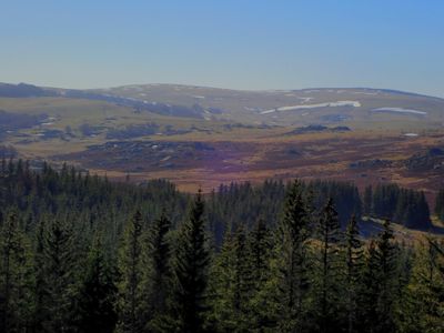
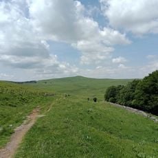
Signal de Mailhebiau is a mountain summit in Aveyron that rises gently from the plateau with steeper slopes on its south and west sides. The peak reaches about 1,500 m (4,900 ft) and presents different climbing angles depending on which direction you approach from.
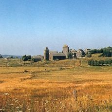
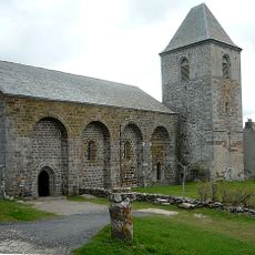
The area was inhabited by shepherds who used traditional stone shelters called burons for shelter and cheese production. These structures are typical of the Massif Central region and show how people historically lived at this elevation.
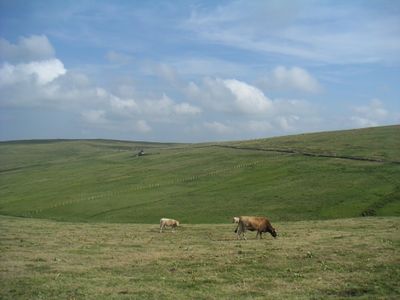
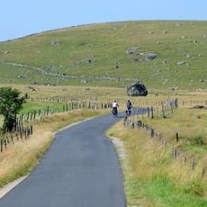
Local farmers use the mountain pastures for summer grazing, letting Aubrac cattle roam freely from May to October across the slopes. This practice shapes how the landscape looks today.
The ascent follows an unmarked path from Saint-Germain-du-Teil toward the Salces pastures, passing through several farm gates along the way. You should close each gate after passing through to keep the grazing cattle contained in their designated areas.
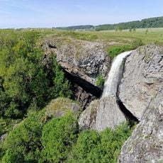
The mountain displays clear volcanic features including pyroclastic tuff and spindle-shaped lava bombs that make it a recognizable volcano in the Aubrac region. These geological characteristics make it a notable spot for anyone curious about how the landscape was shaped by ancient eruptions.
Location: Aveyron
Elevation above the sea: 1,469 m
GPS coordinates: 44.56694,3.08222
Latest update: December 11, 2025 18:07
Château de la Baume
12.7 km
Hospital and order of Aubrac
9.8 km
Parc naturel régional de l'Aubrac
9.6 km
Cascade du Déroc
8.8 km
Château de Pomayrols
11.6 km
Église Notre-Dame-des-Pauvres
9.7 km
Église Sainte-Marie de Nasbinals
11 km
Piou
15.9 km
Puy de Gudette
12.4 km
Pont des Pèlerins
13 kmJardin botanique d'Aubrac
13 km
Tour de Bonnefon
11.2 km
Église Saint-Pierre d'Aurelle
9 km
Église Saint-Laurent de Prades-d'Aubrac
12 km
Église Saint-Jacques de Verlac
9 km
Église Saint-Pierre-et-Saint-Paul de Saint-Pierre-de-Nogaret
11.4 km
Église Saint-Pierre de Marchastel
9.5 km
Église Saint-Laurent de Saint-Laurent-de-Muret
10.7 km
Église Saint-Jacques-le-Majeur de Trélans
7.6 km
Église Saint-Germain de Saint-Germain-du-Teil
12.2 km
Église Sainte-Marie-Madeleine de Lunet
11.7 km
Église Sainte-Anne de Bonnefon
11.2 km
Église Saint-Jean-Baptiste de Pomayrols
11.7 km
Église Saint-Blaise de Born
7.5 km
Église des Crouzets
10.3 km
Église Saint-Roch de la Boulesq
10.6 km
Chapelle Saint-Antoine de Bonnefon
11.1 km
Pont de Chipole
12 kmVisited this place? Tap the stars to rate it and share your experience / photos with the community! Try now! You can cancel it anytime.
Discover hidden gems everywhere you go!
From secret cafés to breathtaking viewpoints, skip the crowded tourist spots and find places that match your style. Our app makes it easy with voice search, smart filtering, route optimization, and insider tips from travelers worldwide. Download now for the complete mobile experience.
A unique approach to discovering new places❞
— Le Figaro
All the places worth exploring❞
— France Info
A tailor-made excursion in just a few clicks❞
— 20 Minutes