Enable Location

We need your location to show you interesting places around you

Discover nearby places

Find interesting locations and hidden gems around you

Precise directions

Get accurate directions and distances to places

Your location is never shared with other users. It's only used when you tap the location button.

Puy de Gudette

Log in to your account

Start exploring — it's free

Trusted by 61,399 travelers worldwide

Continue with Google
Continue with Apple
or

We will send you a code to connect

By continuing, you accept our Terms and Conditions and our Privacy Policy

Check your inbox

We've sent a pincode in your inbox. Please enter the code below.

Puy de Gudette

Puy de Gudette, Volcanic summit in Aubrac, France

Description

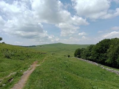
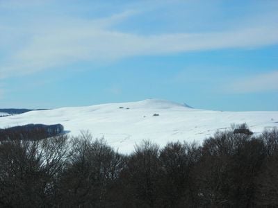
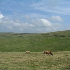
Puy de Gudette is a volcanic peak in the Aubrac region, rising to about 1,400 meters with slopes covered in grassland and basalt formations. The mountain's shape reflects the work of glaciers that sculpted its sides, creating gentle curves and open pastures that reach the summit.

History

The peak formed through intense volcanic activity roughly 7 million years ago, when thick layers of basalt covered the region. This volcanic period shaped the foundation of what would become the Aubrac landscape seen today.

Culture

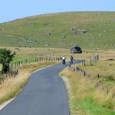
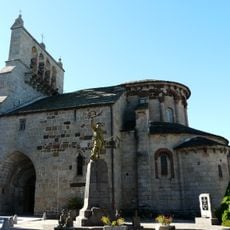
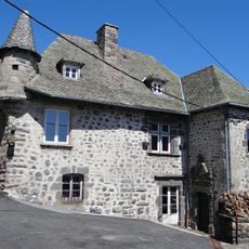
The pastures around the peak are dotted with traditional stone huts that shepherds used for centuries during summer months to work and live. These simple structures shape how the landscape looks today and show how people have adapted to life at this altitude.

Practical

The walk starts from the Buron de Canuc parking area at roughly 1,340 meters, then ascends through open pastures on a straightforward route. The path is easy to follow with clear terrain and basic landmarks, making navigation simple for most walkers.

Did you know?

A geodesic marker stands at the summit as an orientation point for hikers to use. From this spot, views extend across three separate departments that border each other in the region.

Location
Elevation above the sea
1,427 m
Made from material
basalt
Part of
Aubrac
GPS coordinates
44.64987,2.97710
Latest update
December 14, 2025 20:04

AroundUs brings together thousands of curated places, local tips, and hidden gems, enriched daily by 60,000 contributors worldwide. Discover all places nearby (Cantal).

« Puy de Gudette - Volcanic summit in Aubrac, France » is provided by Around Us (aroundus.com). Images and texts are derived from Wikimedia project under a Creative Commons license. You are allowed to copy, distribute, and modify copies of this page, under the conditions set by the license, as long as this note is clearly visible.

Discover hidden gems everywhere you go!

From secret cafés to breathtaking viewpoints, skip the crowded tourist spots and find places that match your style. Our app makes it easy with voice search, smart filtering, route optimization, and insider tips from travelers worldwide. Download now for the complete mobile experience.

Around Us App Screenshot

A unique approach to discovering new places

Le Figaro

All the places worth exploring

France Info

A tailor-made excursion in just a few clicks

20 Minutes

Around Us
Travel Guide & Maps
Download

Send to your phone

QR Code
1

Open the camera app on your mobile.

2

Point at the QR code with your camera. A notification will appear.

3

Tap the notification to open the link.