Les Opies, Mountain summit in Bouches-du-Rhône, France.
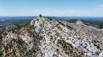
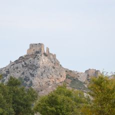
Les Opies is a limestone summit in Provence, standing at approximately 500 meters, covered with Mediterranean vegetation including kermes oak and rosemary. The slopes show the geological weathering characteristic of the region.
The summit's name comes from Aupiho, the Provençal name for the Alpilles, mis-transcribed as "Opies"; Frédéric Mistral traced aupilhoun, "little alp", in his Trésor du Félibrige. The square tower on the highest point was built as a fire lookout, like the vigies raised on other Provençal massifs, and remnants of the telephone line that linked it to Aureille can still be seen. A fire in September 2003 burned part of the western trail.
The name Les Opies comes from a mis-transcription of the Provençal Aupiho, the name of the Alpilles range, meaning "little Alps". Frédéric Mistral, in his Trésor du Félibrige, traced aupilhoun to "small alp"; other scholars link it to a pre-Celtic root *op(p), "height", also behind Latin oppidum.
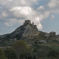
Three trails reach the summit: one from the D25 near the Roquemartine castle ruin (east), one from the D25A toward Aureille, and one from Aureille village below the castle; the last two merge into a single western path. The east and west paths meet at a large cairn, from which a short final climb leads to the top. Access is barred on summer days when the mistral blows hard, because of fire-prevention rules.
The square tower on the summit was built as a fire lookout, modelled on the vigies raised on several Provençal massifs. Remnants of the telephone line that once linked it to Aureille can still be seen. The summit height is given as 496 m in French sources and 498 m in German ones.
The community of curious travelers
AroundUs brings together thousands of curated places, local tips, and hidden gems, enriched daily by 94,040 contributors worldwide.