Joug de l'Aigle, Mountain summit in Sainte-Baume massif, Var, France.
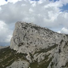
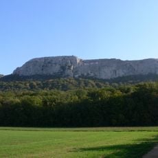
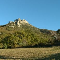
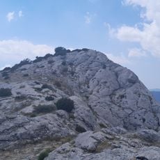
The Joug de l'Aigle is a summit of pale gray and tan limestone in the Sainte-Baume massif, rising to 1148 meters on the border of Signes and Plan-d'Aups-Sainte-Baume. Its crest is a jagged ridge of exposed slabs and boulders with patches of low scrub, and its base spreads into a field of blocky white-gray rocks. The orientation table at Saint-Pilon labels it Joug de l'Aigle but gives 1155 meters.
The Joug de l'Aigle is one of the two culminating points of the Sainte-Baume massif, tied at 1148 metres with the Signal des Béguines to the east. The orientation table on the Saint-Pilon, however, labels it Joug de l'Aigle at 1155 metres. The summit straddles the communes of Signes and Plan-d'Aups-Sainte-Baume in the Var, and it is visible across much of the western part of the department.
The paths to the summit pass through typical Provençal landscapes with pines, herbs, and rock formations that change with the seasons. Visitors experience the rural quiet and the plant life of this high altitude area directly.
Most hiking routes start from Plan-d'Aups-Sainte-Baume and range from short day hikes to longer full-day treks. Visitors should wear proper hiking boots and bring plenty of water, as the exposed slopes offer little shelter from sun and wind.
The summit's height is given as 1,148 m, the same as the Signal des Béguines further east, but the orientation table on the Saint-Pilon lists the Joug de l'Aigle at 1,155 m. The summit is visible across much of the western Var department.
The community of curious travelers
AroundUs brings together thousands of curated places, local tips, and hidden gems, enriched daily by 94,050 contributors worldwide.