Mont Gela, Mountain peak in Peyrieu, France
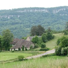
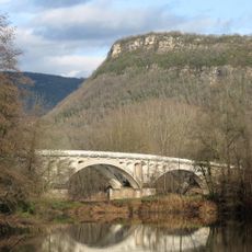
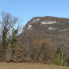
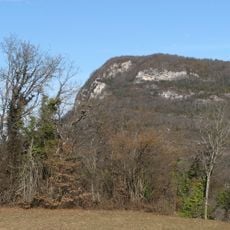
Mont Gela is a 410-meter limestone ridge in the Bugey massif, shared by the communes of Murs-et-Gélignieux and Peyrieu in the Ain. Its lower slopes are densely forested, while the crest exposes pale grey and beige rock in horizontal layers and rounded outcrops. The ridge rises above the Rhône, opposite Mont Tournier on the far bank.
Limestone quarrying has taken place on the mountain since Roman times, using a local stone called Choin de Fay to build structures in Lyon and Vienne. This extraction shaped the landscape over the centuries.
Mont Gela is classified as a zone naturelle d'intérêt écologique, faunistique et floristique (ZNIEFF), a French inventory of areas with notable wildlife and plants. The limestone slopes and ledges of the ridge shelter peregrine falcons, as well as eagle owls, short-toed snake eagles and black kites.
Mont Gela rises to 410 m between Murs-et-Gélignieux and Peyrieu, above the Rhône opposite Mont Tournier. No marked trail or facilities are recorded; access is on foot from the surrounding communes. The limestone crest is bare rock with ledges, so watch your footing near the top.
The limestone of Mont Gela, called choin de Fay, was quarried since Antiquity; the Romans used it for many buildings in Lyon and Vienne. The pale grey and beige rock band along the crest, with its horizontal layers and small ledges, is the same stone the quarrymen cut.
The community of curious travelers
AroundUs brings together thousands of curated places, local tips, and hidden gems, enriched daily by 94,114 contributors worldwide.