Pic d'Anjeau, Limestone summit in Gard, France.
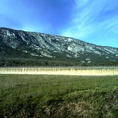
Pic d'Anjeau is a steep limestone peak of 864 metres on the border of the Hérault and Gard departments, above the villages of Saint-Laurent-le-Minier and Gorniès. Its upper half is bare pale grey rock split into jagged ribs and vertical crags, with a blocky cliff on the right, while grass, shrubs and conifers fill the gullies and lower slopes. The deep Vis valley separates it from the Séranne massif, and with the Rochers de la Tude it forms the south-eastern end of the Causse de Blandas.
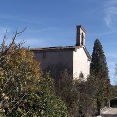
The only built trace on the mountain is the ruined Chapel of Saint-Michel, halfway up the eastern path to the summit. The sources record no construction date or patron, so its origin remains undated; the walls stand at mid-slope, below the bare limestone crags, and mark the route followed by walkers heading for the 864-metre top.
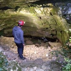
The mountain lies at the southeastern end of the Causse de Blandas, above the villages of Saint-Laurent-le-Minier and Gorniès. The deep Vis valley separates it from the Séranne massif. The ruins of the Saint-Michel chapel stand halfway up the eastern access path, and the Anjeau cave lies about a kilometre to the southeast.
The summit is reached by a path from the east; halfway up that path stand the ruins of the Saint-Michel chapel. The Anjeau cave lies about one kilometre to the south-east and needs no special equipment. The Vis valley separates the peak from the Séranne massif.
About a kilometre southeast of the summit, the Grotte d'Anjeau can be entered without special equipment, according to the French Wikipedia entry. The same source places the ruins of the Chapelle Saint-Michel halfway up the eastern access path, so both can be seen on one climb.
The community of curious travelers
AroundUs brings together thousands of curated places, local tips, and hidden gems, enriched daily by 92,815 contributors worldwide.