Enable Location

We need your location to show you interesting places around you

Discover nearby places

Find interesting locations and hidden gems around you

Precise directions

Get accurate directions and distances to places

Your location is never shared with other users. It's only used when you tap the location button.

Pont de Suresnes

Log in to your account

Start exploring — it's free

Trusted by 62,078 travelers worldwide

Continue with Google
Continue with Apple
or

We will send you a code to connect

By continuing, you accept our Terms and Conditions and our Privacy Policy

Check your inbox

We've sent a pincode in your inbox. Please enter the code below.

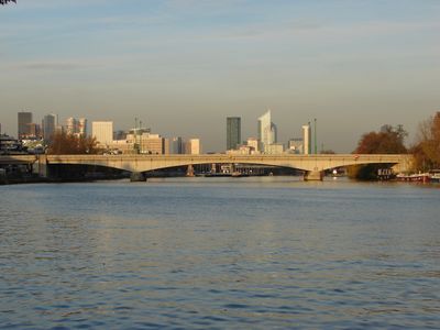
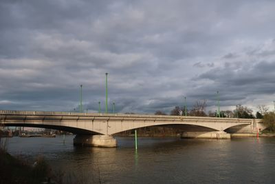
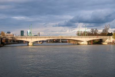
Pont de Suresnes, Road bridge in 16th arrondissement, France

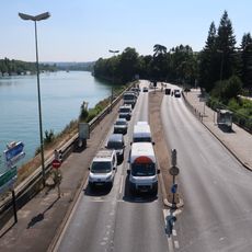
The Pont de Suresnes is a road bridge crossing the Seine River, linking the Bois de Boulogne with the town of Suresnes. It spans 200 meters with a 30-meter width and carries multiple lanes of traffic.

The present structure was built in 1951, replacing earlier bridges including a suspension bridge from 1842 and a metal structure from 1874. Its construction marked a shift toward modern engineering for cross-river connections in this area.

The bridge displays sculptured coats of arms for Paris and Suresnes, symbolizing the link between the city and its suburbs. These artworks reflect how infrastructure became a source of shared identity between communities.

The bridge accommodates pedestrians and vehicles, with walkways on both sides for foot traffic. Access is straightforward and the structure is freely accessible to anyone crossing the river.

The original suspension bridge was deliberately destroyed by local residents during the Franco-Prussian War in 1870 to prevent Prussian troops from advancing toward Paris. This action revealed how communities took active roles in defense during wartime emergencies.

The community of curious travelers

AroundUs brings together thousands of curated places, local tips, and hidden gems, enriched daily by 60,000 contributors worldwide.

Start exploring
Location
Location
Length
200 m
Width
30 m
Part of
road network of Paris
Shares border with
Boulevard Henri-Sellier, route de Suresnes
GPS coordinates
48.86670,2.22944
Latest update
December 12, 2025 16:43
« Pont de Suresnes - Road bridge in 16th arrondissement, France » is provided by Around Us (aroundus.com). Images and texts are derived from Wikimedia project under a Creative Commons license. You are allowed to copy, distribute, and modify copies of this page, under the conditions set by the license, as long as this note is clearly visible.

Discover hidden gems everywhere you go!

From secret cafés to breathtaking viewpoints, skip the crowded tourist spots and find places that match your style. Our app makes it easy with voice search, smart filtering, route optimization, and insider tips from travelers worldwide. Download now for the complete mobile experience.

Around Us App Screenshot

A unique approach to discovering new places

Le Figaro

All the places worth exploring

France Info

A tailor-made excursion in just a few clicks

20 Minutes

Around Us
Travel Guide & Maps
Download

Send to your phone

QR Code
1

Open the camera app on your mobile.

2

Point at the QR code with your camera. A notification will appear.

3

Tap the notification to open the link.