Roc'h Trédudon, Mountain summit in Monts d'Arrée, Brittany, France.
Description
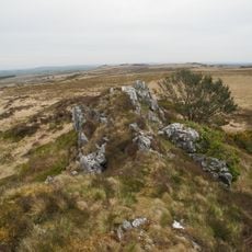
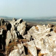
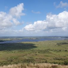
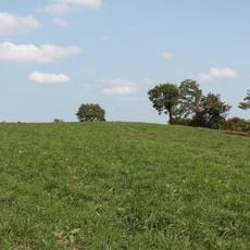
Roc'h Trédudon is a mountain summit in the Monts d'Arrée range in Brittany, reaching approximately 385 meters in elevation. The peak features distinctive granite formations and stands among the highest points of the Armorican mountains in western France.
History
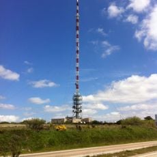
The summit became a symbol of Breton resistance in the 1970s when activists destroyed the transmitter station located there. This attack disrupted television broadcasts across western Brittany and left a lasting mark on local history.
Culture
The summit serves as a natural gathering point for people exploring the rural landscape of this corner of Brittany. The paths connecting here link small villages and farmland that shape the character of the region.
Practical
The summit is accessible by hiking and mountain biking trails of varying difficulty that begin from different points in the area. Visitors should be prepared for changing weather conditions, as the elevation can bring rapid shifts throughout the day.
Did you know?
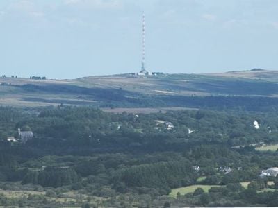
A transmitter station crowning the summit is visible from far across the surrounding lowlands and has shaped the peak's appearance for decades. This structure has become a landmark for people traveling through the surrounding countryside.
AroundUs brings together thousands of curated places, local tips, and hidden gems, enriched daily by 60,000 contributors worldwide. Discover all places nearby (Finistère).
Roc'h Ruz
309 m
Roc'h Trevezel
2.5 km
Émetteur de Roc'h Trédudon
958 m
Réservoir Saint-Michel
6.7 km
Abbaye du Relec
4.7 km
Commana parish close
5.8 km
Ti ar Boutiged
6.3 km
Plounéour-Ménez Parish close
2.9 km
Réserve naturelle nationale du Venec
5.6 km
Brennilis Parish close
6.8 km
Église Saint-Yves de Plounéour-Ménez
2.9 km
Lit de Saint-Eneour
4.4 km
Ossuaire de Commana
5.9 km
Église Saint-Jean-Baptiste de La Feuillée
3.1 km
Église Saint-Derrien de Commana
5.8 km
Ancienne église Saint-Eutrope de Botmeur
4.7 km
Abbatiale Notre-Dame du Relec
4.7 km
Église Saint-Eutrope-et-Saint-Isidore de Botmeur
4.7 km
Calvaire de 1624 de l'enclos paroissial de Commana
5.8 km
Chapelle Saint-Divy de Plounéour-Ménez
4.1 km
Arc de triomphe de Commana
5.9 km
Calvaire de l'enclos paroissial de Commana
5.9 km
Arc de triomphe de l'Enclos paroissial de Plounéour-Ménez
2.9 km
Tumulii de Kerelcun
5 km
Calvaire sud de l'Enclos paroissial de Plounéour-Ménez
2.9 km
Calvaire ouest de l'Enclos paroissial de Plounéour-Ménez
2.9 km
Calvaire de l'enclos paroissial de Brennilis
6.7 km
Chapelle Saint-Houardon
3 kmDiscover hidden gems everywhere you go!
From secret cafés to breathtaking viewpoints, skip the crowded tourist spots and find places that match your style. Our app makes it easy with voice search, smart filtering, route optimization, and insider tips from travelers worldwide. Download now for the complete mobile experience.
A unique approach to discovering new places❞
— Le Figaro
All the places worth exploring❞
— France Info
A tailor-made excursion in just a few clicks❞
— 20 Minutes