Signal de la Mère Boitier, Highest peak of the Mâconnais Mountains in Tramayes, France.
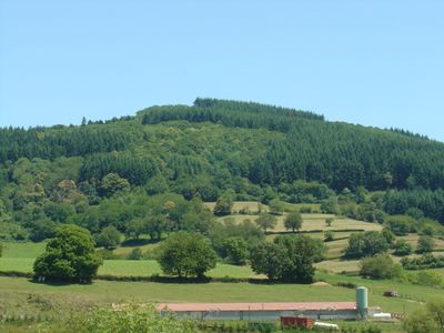
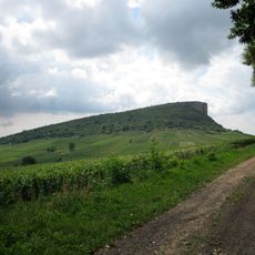
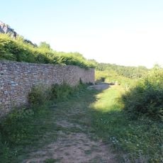
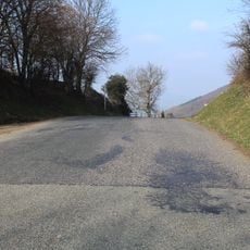
Signal de la Mère Boitier is the highest peak of the Mâconnais Mountains at 758 meters elevation in Saône-et-Loire. Steep embankments characterize the western side while gentle slopes define the eastern aspect.
The site was originally known as la mure Boitier and took its name from a local tale about an innkeeper murdered during the stagecoach era. This old story has preserved the peak's current designation.
The name of this summit echoes through the Saint-Cyr Mère Boitier municipal community and the local brass band. Visitors encounter this local identity woven into the names of surrounding places.
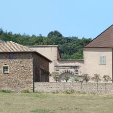
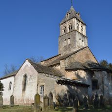
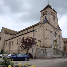
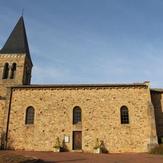
The hiking trail starts from the parking area behind Serrières church and covers about 16 kilometers with roughly 600 meters of elevation gain. Plan several hours for this hike and note that conditions vary depending on weather.
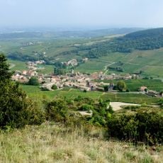
On clear days, hikers can see Mont Blanc from this summit, making it a remarkable vantage point. The view reaches across the flat landscapes of Bresse and Beaujolais toward this legendary massif.
Location: Saône-et-Loire
Location: Tramayes
Elevation above the sea: 758 m
GPS coordinates: 46.30257,4.63213
Latest update: December 14, 2025 16:44
Rock of Solutré
6.6 km
Château de Saint-Point
4.7 km
Château de Pierreclos
5.2 km
Rock of Vergisson
6.6 km
Parc archéologique et botanique de Solutré
6.8 km
Château de Corcelle
6.7 km
Château de Tramayes
2.3 km
Château des Essertaux
6.7 km
Menhir de Chancerons
6.4 km
Église Saint-Donat de Saint-Point
4.6 km
Château de Gorze
4.4 km
Église Saint-Jean-Baptiste de Tramayes
2.7 km
Église de la Conversion-de-Saint-Paul de Bussières
6.6 km
Gisement préhistorique de Solutré
6.7 km
Église Saint-Martin de Vergisson
6.4 km
Église Saint-Jacques-le-Majeur de Serrières
4 km
Église Sainte-Foy de Cenves
4 km
Église Sainte-Marie-Magdeleine de Saint-Mamert
6.9 km
Église Saint-Martin de Pierreclos
5.5 km
Église Saint-Éloi de Trades
6.1 km
Église Saint-Jacques de Saint-Jacques-des-Arrêts
5.8 km
Église Saint-Blaise de Germolles-sur-Grosne
4 km
Église Saint-Léger de Saint-Léger-sous-la-Bussière
6 km
Lavoir de Vergisson
6.5 km
Chapelle Saint-Fiacre de la Grange du Bois
5.2 km
Lavoir of Pierreclos
5.6 km
Château de Gorze
4.4 km
Col de Gerbet
5.1 kmVisited this place? Tap the stars to rate it and share your experience / photos with the community! Try now! You can cancel it anytime.
Discover hidden gems everywhere you go!
From secret cafés to breathtaking viewpoints, skip the crowded tourist spots and find places that match your style. Our app makes it easy with voice search, smart filtering, route optimization, and insider tips from travelers worldwide. Download now for the complete mobile experience.
A unique approach to discovering new places❞
— Le Figaro
All the places worth exploring❞
— France Info
A tailor-made excursion in just a few clicks❞
— 20 Minutes