Enable Location

We need your location to show you interesting places around you

Discover nearby places

Find interesting locations and hidden gems around you

Precise directions

Get accurate directions and distances to places

Your location is never shared with other users. It's only used when you tap the location button.

L'Élancèze

Log in to your account

Start exploring — it's free

Trusted by 63,312 travelers worldwide

Continue with Google
Continue with Apple
or

We will send you a code to connect

By continuing, you accept our Terms and Conditions and our Privacy Policy

Check your inbox

We've sent a pincode in your inbox. Please enter the code below.

L'Élancèze
Discussion Reviews 1 Photos
700+ Popularity

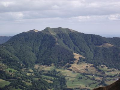
L'Élancèze, Free flight site and summit in Cantal, France

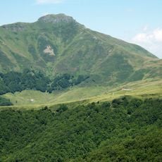
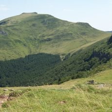
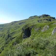
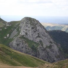
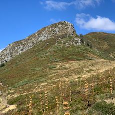
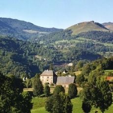
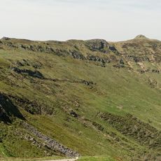
L'Élancèze is a 1571-meter summit in the Cantal massif with slopes suited for both hiking and free flight activities. The mountain features varied terrain across its flanks that supports these different outdoor pursuits.

The peak stands on the volcanic Cantal massif, which formed millions of years ago through repeated eruptions that reshaped the region. This geological history created the mountain landscape visible today.

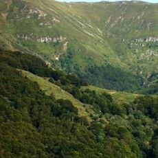
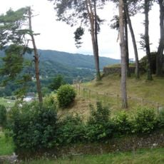
Shepherds drive their Salers cattle to summer pastures surrounding the peak, where this age-old herding practice remains visible in daily farm life. The grazing herds help shape how the landscape looks and feels throughout the season.

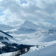
The trail to the summit starts at Col du Pertus, following the marked GR400 hiking route that goes straight to the top. Visitors should prepare for exposed mountain slopes and bring proper gear for changing weather.

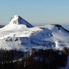
The wind and air flow conditions here allow paragliders to fly long routes with views of both Puy Mary and Plomb du Cantal in the distance. This sightline between multiple volcanic peaks makes it especially rewarding for experienced pilots.

The community of curious travelers

AroundUs brings together thousands of curated places, local tips, and hidden gems, enriched daily by 60,000 contributors worldwide.

Start exploring
Location
Elevation above the sea
1,571 m
GPS coordinates
45.05161,2.66508
Latest update
December 14, 2025 20:01
Reviews
Share your experience

No review yet

Discussions
Start a discussion...

No discussion yet

« L'Élancèze - Free flight site and summit in Cantal, France » is provided by Around Us (aroundus.com). Images and texts are derived from Wikimedia project under a Creative Commons license. You are allowed to copy, distribute, and modify copies of this page, under the conditions set by the license, as long as this note is clearly visible.

Discover hidden gems everywhere you go!

From secret cafés to breathtaking viewpoints, skip the crowded tourist spots and find places that match your style. Our app makes it easy with voice search, smart filtering, route optimization, and insider tips from travelers worldwide. Download now for the complete mobile experience.

Around Us App Screenshot

A unique approach to discovering new places

Le Figaro

All the places worth exploring

France Info

A tailor-made excursion in just a few clicks

20 Minutes

Around Us
Travel Guide & Maps
Download

Send to your phone

QR Code
1

Open the camera app on your mobile.

2

Point at the QR code with your camera. A notification will appear.

3

Tap the notification to open the link.