Enable Location

We need your location to show you interesting places around you

Discover nearby places

Find interesting locations and hidden gems around you

Precise directions

Get accurate directions and distances to places

Your location is never shared with other users. It's only used when you tap the location button.

Bec de l'Aigle

Log in to your account

Start exploring — it's free

Trusted by 61,397 travelers worldwide

Continue with Google
Continue with Apple
or

We will send you a code to connect

By continuing, you accept our Terms and Conditions and our Privacy Policy

Check your inbox

We've sent a pincode in your inbox. Please enter the code below.

Bec de l'Aigle

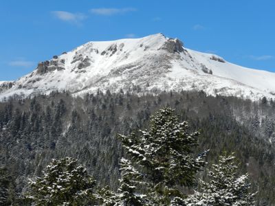
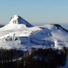
Bec de l'Aigle, Mountain summit in Cantal, France

Description

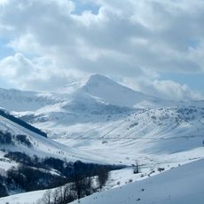
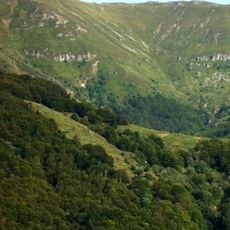
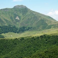
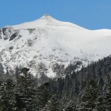
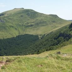
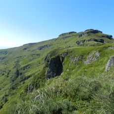
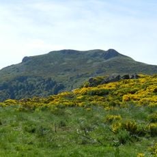
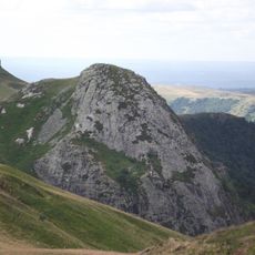
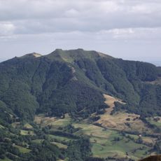
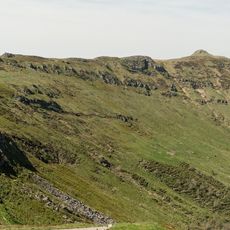
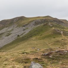
Bec de l'Aigle is a mountain summit standing at approximately 1700 meters (5575 feet) in the eastern section of the Cantal stratovolcano in the Auvergne-Rhône-Alpes region. The peak is covered with forests and pastures that give way to panoramic views across the surrounding terrain.

History

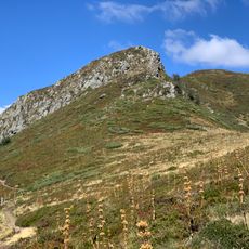
The peak formed through intense volcanic activity dating back 8.5 to 6.5 million years ago, when trachyandesitic lava flows shaped the surrounding landscape. This geological history makes the area an important record of Auvergne's mountain-building processes.

Culture

The mountain's name comes from its distinctive shape, which resembles an eagle's head when viewed from certain angles in the surrounding valleys. This naming reflects how locals and visitors perceive the striking profile of the peak.

Practical

The GR 400 hiking trail offers the most accessible route to reach the summit, while the path from Font d'Alagnon requires more effort and passes through denser forests. Hikers should prepare for changing weather conditions and wear sturdy footwear.

Did you know?

Several streams originate from the mountain's slopes, including La Croix, Loubaleyre, Chavagnac, and La Grange, which feed into the Alagnon Valley water system. These sources form the starting point for a network of watercourses that support the surrounding ecosystems.

Location
Elevation above the sea
1,700 m
GPS coordinates
45.09920,2.74004
Latest update
December 14, 2025 20:01

AroundUs brings together thousands of curated places, local tips, and hidden gems, enriched daily by 60,000 contributors worldwide. Discover all places nearby (Cantal).

« Bec de l'Aigle - Mountain summit in Cantal, France » is provided by Around Us (aroundus.com). Images and texts are derived from Wikimedia project under a Creative Commons license. You are allowed to copy, distribute, and modify copies of this page, under the conditions set by the license, as long as this note is clearly visible.

Discover hidden gems everywhere you go!

From secret cafés to breathtaking viewpoints, skip the crowded tourist spots and find places that match your style. Our app makes it easy with voice search, smart filtering, route optimization, and insider tips from travelers worldwide. Download now for the complete mobile experience.

Around Us App Screenshot

A unique approach to discovering new places

Le Figaro

All the places worth exploring

France Info

A tailor-made excursion in just a few clicks

20 Minutes

Around Us
Travel Guide & Maps
Download

Send to your phone

QR Code
1

Open the camera app on your mobile.

2

Point at the QR code with your camera. A notification will appear.

3

Tap the notification to open the link.