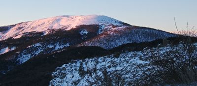
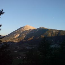
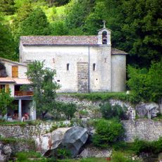
Puy de Rent, Mountain summit in Alpes-de-Haute-Provence, France
Puy de Rent is a mountain in the Alpes-de-Haute-Provence rising to approximately 2,000 meters. The route climbs through distinct vegetation zones, starting with dense pine forests and transitioning to larch groves before reaching the exposed rocky peak.
Reforestation of the mountain began in 1860 as part of a national program to repair erosion damage across the Alps. This initiative followed severe mountain flooding that had devastated the region years earlier.
The mountain paths showcase the regional flora, with thyme, savory herbs, and larch trees growing along the trails from base to summit.
Parking is available at the Tuilière area where the trail begins, and the climb takes several hours to complete. The route is best attempted in dry conditions, as the rocky summit section becomes slippery and challenging when wet.
The peak marks the watershed line between the Var and Verdon rivers, making it a geographic dividing point for two separate drainage systems. Lichens in the larch forests serve as natural indicators of air quality in the region.
Location: Alpes-de-Haute-Provence
Elevation above the sea: 1,996 m
GPS coordinates: 44.02109,6.59021
Latest update: December 14, 2025 20:03
Pont du Moulin
9 km
Grotte des Chamois
9.3 km
Grotte du Cul de Bœuf
4.6 km
Grotte du Trou-Madame
3.2 km
Grotte de Font Gaillarde
4.6 km
Montagne de Cordeil
7.1 km
Pertuis de Méailles
3.4 km
Chapelle Notre-Dame de Vers-la-Ville
8.7 km
Trou Miette
3.4 km
Croix couverte d'Annot
9.3 km
Chapelle Saint-Thomas de Thorame-Basse
11.2 km
Pont sur la Vaire
4.4 km
Église Saint-Barthélémy de Moriez
11.6 km
Église Saint-André de Saint-André-les-Alpes
9 km
Trou de Chalvet
9.4 km
Les deux saints
9.7 km
Église Notre-Dame-et-Saint-Honorat d'Angles
9 km
Chapelle de Vérimande
8.1 km
Église Saint-Martin de Braux
9.5 km
Église Saint-Martin d'Allons
4.9 km
Église Saint-Pons du Fugeret
4.7 km
Église Saint-Jean-Baptiste d'Annot
8.6 km
Chambre du Roi
9.9 km
Grès d'Annot
9.9 km
Chapelle Saint-Joseph de Bontès
5.6 km
Chapelle Saint-Domnin de La Tuilière
2.9 km
Chapelle Notre-Dame-de-la-Fleur de Thorame-Haute-Gare
3.1 km
Guillaumasse Viaduct
3.2 kmVisited this place? Tap the stars to rate it and share your experience / photos with the community! Try now! You can cancel it anytime.
Discover hidden gems everywhere you go!
From secret cafés to breathtaking viewpoints, skip the crowded tourist spots and find places that match your style. Our app makes it easy with voice search, smart filtering, route optimization, and insider tips from travelers worldwide. Download now for the complete mobile experience.
A unique approach to discovering new places❞
— Le Figaro
All the places worth exploring❞
— France Info
A tailor-made excursion in just a few clicks❞
— 20 Minutes