Enable Location

We need your location to show you interesting places around you

Discover nearby places

Find interesting locations and hidden gems around you

Precise directions

Get accurate directions and distances to places

Your location is never shared with other users. It's only used when you tap the location button.

Pic du Lizieux

Log in to your account

Start exploring — it's free

Trusted by 62,396 travelers worldwide

Continue with Google
Continue with Apple
or

We will send you a code to connect

By continuing, you accept our Terms and Conditions and our Privacy Policy

Check your inbox

We've sent a pincode in your inbox. Please enter the code below.

Pic du Lizieux

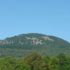
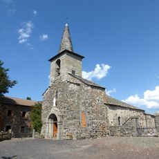
Pic du Lizieux, Volcanic mountain peak in Haute-Loire, France.

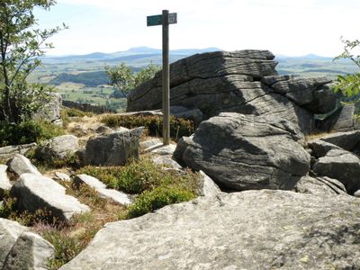
Pic du Lizieux rises to 1,388 meters (4,554 feet) within the Meygal massif and displays distinctive rock formations made of phonolite. The mountain has steep flanks and offers wide views across surrounding valleys and peaks from its summit.

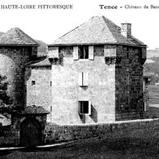
An ancient fortress called Bonas once stood on the mountain's southern slopes, first recorded in 1165 and later rebuilt as a Gothic castle under church control. It was destroyed in 1565, leaving only traces in the landscape today.

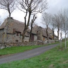
The area has long been home to herders and farmers who kept cattle and grew berries in these highlands. These activities still shape how people use and view the landscape today.

The mountain is accessible via two main hiking routes, with the Bonas trail requiring roughly 90 minutes to the summit where an orientation marker stands. Strong hiking boots and weather-resistant gear are advisable since conditions change quickly at this elevation.

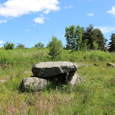
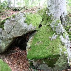
The phonolite rocks at the summit produce distinctive musical tones when struck. This rare geological property makes the location a curious natural phenomenon that few visitors know about.

The community of curious travelers

AroundUs brings together thousands of curated places, local tips, and hidden gems, enriched daily by 60,000 contributors worldwide.

Start exploring
Location
Elevation above the sea
1,388 m
GPS coordinates
45.06153,4.19590
Latest update
December 6, 2025 17:45
Natural and cultural spots in Auvergne-Rhône-Alpes

The Auvergne-Rhône-Alpes region offers a mix of nature and history. Walking paths lead through valleys and past waterfalls, while medieval castles stand on hilltops and ridges. Volcanic peaks rise from the landscape, and caves open into the earth below. You will find the Massif Central, alpine...

« Pic du Lizieux - Volcanic mountain peak in Haute-Loire, France » is provided by Around Us (aroundus.com). Images and texts are derived from Wikimedia project under a Creative Commons license. You are allowed to copy, distribute, and modify copies of this page, under the conditions set by the license, as long as this note is clearly visible.

Discover hidden gems everywhere you go!

From secret cafés to breathtaking viewpoints, skip the crowded tourist spots and find places that match your style. Our app makes it easy with voice search, smart filtering, route optimization, and insider tips from travelers worldwide. Download now for the complete mobile experience.

Around Us App Screenshot

A unique approach to discovering new places

Le Figaro

All the places worth exploring

France Info

A tailor-made excursion in just a few clicks

20 Minutes

Around Us
Travel Guide & Maps
Download

Send to your phone

QR Code
1

Open the camera app on your mobile.

2

Point at the QR code with your camera. A notification will appear.

3

Tap the notification to open the link.