Enable Location

We need your location to show you interesting places around you

Discover nearby places

Find interesting locations and hidden gems around you

Precise directions

Get accurate directions and distances to places

Your location is never shared with other users. It's only used when you tap the location button.

Log in to your account

Start exploring — it's free

Trusted by 68,068 travelers worldwide

Continue with Google
Continue with Apple
or

We will send you a code to connect

By continuing, you accept our Terms and Conditions and our Privacy Policy

Check your inbox

We've sent a pincode in your inbox. Please enter the code below.

La Tour de l'Angle Est
Discussion Reviews Photo
100+ Popularity

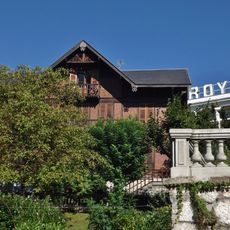
La Tour de l'Angle Est, Summit in Savoy Pre-Alps, France

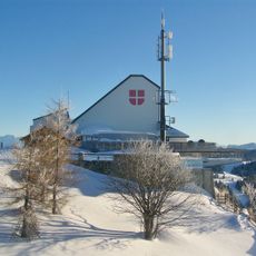
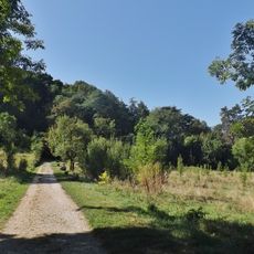
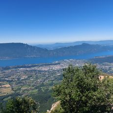
La Tour de l'Angle Est is a summit in the Savoy Pre-Alps that rises to about 1200 meters and offers views across the Alpine landscape and Lake Bourget. The area is shaped by forests and mountain meadows that give the hike a natural character.

Shepherds have moved through this region for centuries, creating and maintaining pathways as they moved herds seasonally between lower and higher elevations. These traditional routes became embedded in the landscape and remain in use today.

The walking routes here trace paths that shepherds have used for generations to move their flocks across forests and high meadows throughout the seasons.

The hike begins near Route du Revard where parking is available, and takes about three and a half hours with elevation gain of around 450 meters. Bring sturdy footwear and plenty of water, as the path crosses different terrain and changes in surface conditions.

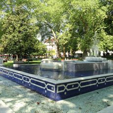
At the base of this summit lies the source of the Sierroz River, fed by small springs that flow downward into the lake below. Many walkers find this hidden spring source an unexpected discovery during their climb.

The community of curious travelers

AroundUs brings together thousands of curated places, local tips, and hidden gems, enriched daily by 60,000 contributors worldwide.

Start exploring
Elevation above the sea
1,171 m
GPS coordinates
45.68966,5.98956
Latest update
December 15, 2025 13:29
Reviews
Share your experience

No review yet

Discussions
Start a discussion...

No discussion yet

« La Tour de l'Angle Est - Summit in Savoy Pre-Alps, France » is provided by Around Us (aroundus.com). Images and texts are derived from Wikimedia project under a Creative Commons license. You are allowed to copy, distribute, and modify copies of this page, under the conditions set by the license, as long as this note is clearly visible.

Discover hidden gems everywhere you go!

From secret cafés to breathtaking viewpoints, skip the crowded tourist spots and find places that match your style. Our app makes it easy with voice search, smart filtering, route optimization, and insider tips from travelers worldwide. Download now for the complete mobile experience.

Around Us App Screenshot

A unique approach to discovering new places

Le Figaro

All the places worth exploring

France Info

A tailor-made excursion in just a few clicks

20 Minutes

Around Us
Travel Guide & Maps
Download

Send to your phone

QR Code
1

Open the camera app on your mobile.

2

Point at the QR code with your camera. A notification will appear.

3

Tap the notification to open the link.