Enable Location

We need your location to show you interesting places around you

Discover nearby places

Find interesting locations and hidden gems around you

Precise directions

Get accurate directions and distances to places

Your location is never shared with other users. It's only used when you tap the location button.

Mustaviiri

Log in to your account

Start exploring — it's free

Trusted by 62,380 travelers worldwide

Continue with Google
Continue with Apple
or

We will send you a code to connect

By continuing, you accept our Terms and Conditions and our Privacy Policy

Check your inbox

We've sent a pincode in your inbox. Please enter the code below.

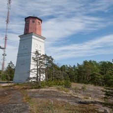
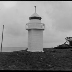
Mustaviiri, geodetic marker in Finland

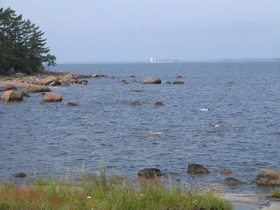
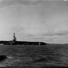
Mustaviiri is a small island near Pyhtää in Finland and part of a UNESCO World Heritage Site. It has a rocky landscape with a measurement station from the Struve Geodetic Arc, an observation tower, and remains of old structures and stone arrangements.

The island has been visited by people since the 18th century and served as a navigation point. The Grönholm family settled there in 1873 and lived by fishing until the early 20th century, after which it became uninhabited.

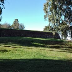
Mustaviiri served as a navigation point for fishers and boat travelers in the region for many generations. The stone arrangements and rocky shores show how people used this coastal area to move across the sea and conduct their daily work.

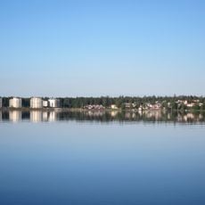
Reaching the island requires your own boat or a hired water taxi since there is no regular ferry service. The island is exposed to open sea and weather conditions affect access, so experience with small boats is important.

The measurement point here is the southernmost station of the Struve Geodetic Arc in Finland, a 19th century project to survey the Earth from the Arctic to the Black Sea. This historic station on bare rock is a rare witness to this scientific effort.

The community of curious travelers

AroundUs brings together thousands of curated places, local tips, and hidden gems, enriched daily by 60,000 contributors worldwide.

Start exploring
Location
Part of
Struve Geodetic Arc
GPS coordinates
60.27670,26.60345
Latest update
February 9, 2026 07:41
« Mustaviiri - geodetic marker in Finland » is provided by Around Us (aroundus.com). Images and texts are derived from Wikimedia project under a Creative Commons license. You are allowed to copy, distribute, and modify copies of this page, under the conditions set by the license, as long as this note is clearly visible.

Discover hidden gems everywhere you go!

From secret cafés to breathtaking viewpoints, skip the crowded tourist spots and find places that match your style. Our app makes it easy with voice search, smart filtering, route optimization, and insider tips from travelers worldwide. Download now for the complete mobile experience.

Around Us App Screenshot

A unique approach to discovering new places

Le Figaro

All the places worth exploring

France Info

A tailor-made excursion in just a few clicks

20 Minutes

Around Us
Travel Guide & Maps
Download

Send to your phone

QR Code
1

Open the camera app on your mobile.

2

Point at the QR code with your camera. A notification will appear.

3

Tap the notification to open the link.