Chest opened
+${chestReward.xp} XP
Explorer
NOUVEAU ×${chestReward.collectible.quantity}
tapez pour fermer
Chest locked

Open chests in the app

Around Us is built for your phone — chests unlock when you walk, explore and capture nearby places.

Enable Location

We need your location to show you interesting places around you

Discover nearby places

Find interesting locations and hidden gems around you

Precise directions

Get accurate directions and distances to places

Your location is never shared with other users. It's only used when you tap the location button.

Hungary–Romania border

Log in to your account

Start exploring — it's free

Trusted by 72,890 travelers worldwide

Continue with Google
Continue with Apple
or

We will send you a code to connect

By continuing, you accept our Terms and Conditions and our Privacy Policy

Check your inbox

We've sent a pincode in your inbox. Please enter the code below.

Discussion Reviews 3 Photos
21.1k Popularity

Hungary–Romania border, international border

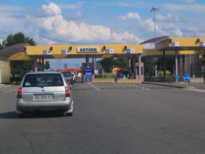
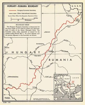
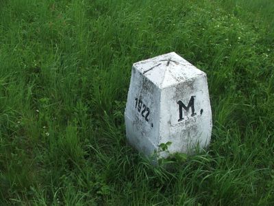
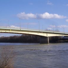
The Hungary-Romania border is an international land boundary running roughly north to south for about 448 kilometers (278 miles), with several official crossing points for travelers and freight. The line passes mostly through the flat Pannonian Basin and is partly defined by the Mures river, with stone markers indicating the exact frontier.

This boundary was drawn in 1920 by the Treaty of Trianon after World War I, which assigned Transylvania to Romania and significantly reduced Hungary's territory. The line was confirmed after World War II and has not moved since.

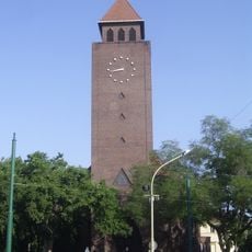
Near several crossing points, towns on both sides share a Hungarian-speaking population, which gives the region a bilingual character that you notice in street signs and everyday conversations. People cross regularly for shopping or family visits, which makes the border feel more like a meeting point than a dividing line.

Romania joined the Schengen Area for air and sea travel in 2024, but land border checks may still apply depending on the crossing point and travel documents. Choosing a less busy crossing and avoiding peak travel times like weekends and public holidays can save a lot of waiting.

When the border was drawn in 1920, the final line did not always follow the ethnic boundaries that had been proposed, leaving large Hungarian-speaking communities on the Romanian side. This is still visible today in the bilingual place names found in many towns in the border region of Transylvania.

The community of curious travelers

AroundUs brings together thousands of curated places, local tips, and hidden gems, enriched daily by 60,000 contributors worldwide.

Start exploring
Inception
1920
Part of
border of Hungary, borders of Romania
GPS coordinates
46.11667,20.26667
Latest update
March 3, 2026 08:22
Reviews
Share your experience

No review yet

Discussions
Start a discussion...

No discussion yet

« Hungary–Romania border - international border » is provided by Around Us (aroundus.com). Images and texts are derived from Wikimedia project under a Creative Commons license. You are allowed to copy, distribute, and modify copies of this page, under the conditions set by the license, as long as this note is clearly visible.

Discover hidden gems everywhere you go!

From secret cafés to breathtaking viewpoints, skip the crowded tourist spots and find places that match your style. Our app makes it easy with voice search, smart filtering, route optimization, and insider tips from travelers worldwide. Download now for the complete mobile experience.

Around Us App Screenshot

A unique approach to discovering new places

Le Figaro

All the places worth exploring

France Info

A tailor-made excursion in just a few clicks

20 Minutes

Around Us
Travel Guide & Maps
Download

Send to your phone

QR Code
1

Open the camera app on your mobile.

2

Point at the QR code with your camera. A notification will appear.

3

Tap the notification to open the link.