Simpang Tiga, district in Aceh Besar Regency, Aceh Province, Indonesia
Location: Great Aceh
Elevation above the sea: 208 m
GPS coordinates: 5.35000,95.31667
Latest update: March 9, 2025 14:14

Baiturrahman Grand Mosque
22.7 km
Aceh Tsunami Museum
22 km
Apung 1
21.9 km
Harapan Bangsa Stadium
19.2 km
Cot Seulawah Agam
39.1 km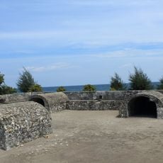
Indrapatra Fort
36 km
Iboih Beach
58.6 km
Indrapuri Old Mosque
16.1 km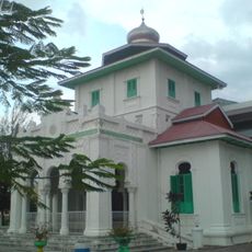
Baiturrahim Mosque
23.2 km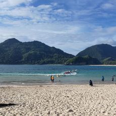
Pantai Lampuuk
18.5 km
Aceh Museum
22.1 km
H. Dimurthala Stadium
24.1 km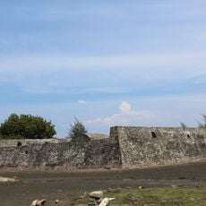
Indra Patra Fortress
36 km
Pedir Museum
84.3 km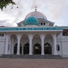
Hidayatul Islam Mosque
24 km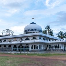
Lambaro Angan Grand Mosque
28.1 km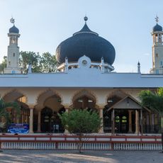
Baitul Makmur Ateuk Mosque
21.7 km
Sabili Jannah Mosque
23.2 km
Kajhu Grand Mosque
28.3 km
Krueng Cut Bridge
26.5 km
Bueng Cala Seupe Mosque
22.3 km
Al-Falah Namploh Mosque
116.9 km
Lambada Lhok Grand Mosque
30.2 km
Lamrabo Great Mosque
23.7 km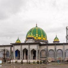
Nurul Huda Mosque
20.5 km
Nurul Huda Mosque
24.3 km
Ceurucok Mosque
119 km
Mesjid Tgk Dianjong
23.9 kmReviews
Visited this place? Tap the stars to rate it and share your experience / photos with the community! Try now! You can cancel it anytime.
Discover hidden gems everywhere you go!
From secret cafés to breathtaking viewpoints, skip the crowded tourist spots and find places that match your style. Our app makes it easy with voice search, smart filtering, route optimization, and insider tips from travelers worldwide. Download now for the complete mobile experience.

A unique approach to discovering new places❞
— Le Figaro
All the places worth exploring❞
— France Info
A tailor-made excursion in just a few clicks❞
— 20 Minutes