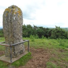
Galtymore, Mountain summit between County Limerick and County Tipperary, Ireland
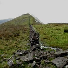
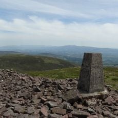
Galtymore is the highest peak of the Galty Mountains, a grass-covered east–west range of Old Red Sandstone and Silurian shale that runs for 30 km along the border of County Tipperary and County Limerick. Its northern face drops steeply into deep glacial corries holding lakes such as Lough Curra and Lough Diheen, while the summit is capped by tors of Slievenamuck Conglomerate.
Galtymore is recorded as early as the Civil Survey of County Tipperary (Down Survey, 1654–56) as a boundary feature of the barony of Clanwilliam. The summit is marked as Dawson's Table, named after the Dawson-Massey family, large landowners in the area (Tipperary Directory 1889). The range was historically called Sliabh gCrot, anglicised as Slievegrot, or Crotta Cliach.
The name Galtymore anglicises the Irish Cnoc Mór na nGaibhlte, 'big hill of the Galtees', recorded as a boundary of the barony of Clanwilliam in the 1654–56 Civil Survey. The summit is marked Dawson's Table, after the Dawson-Massey family who owned land on the range's north side. Folklore links the mountain and its corrie lakes to Saint Patrick and serpents.
The ascent is best attempted in dry conditions, as muddy sections can make the path slippery. Proper hiking boots and weather protection are essential, especially near the top where wind is stronger.
The summit is marked as Dawson's Table, named after the Dawson-Massey family, large landowners in the area recorded in the Tipperary Directory of 1889, who owned much of the land on and around the northern section of the Galty range.
The community of curious travelers
AroundUs brings together thousands of curated places, local tips, and hidden gems, enriched daily by 94,281 contributors worldwide.