Lyracappul, Mountain summit in County Limerick, Ireland.
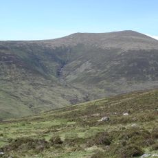
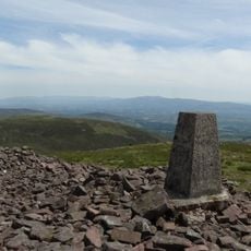
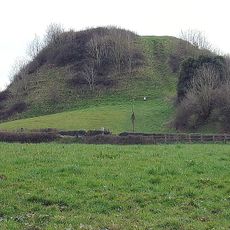
Lyracappul is a mountain in the Galtee Mountains, standing 825 metres high at the south-eastern end of County Limerick. It is the second highest of the Galtees and the 29th highest peak in Ireland. Its main path leaves from a car park near the village of Kilbehenny, a few kilometres north of the M8.
Lyracappul lies at the south-eastern end of County Limerick, on the Galtee range that forms the historic boundary between counties Limerick and Tipperary. At 825 metres it is the second-highest of the Galtee Mountains and the 29th highest peak in Ireland, and the second-highest point in County Limerick.
The name Lyracappul comes from the Irish Ladhar an Chapaill, meaning 'fork or confluence of the horse'. The name is the main cultural marker recorded for the mountain, and it is the form used on maps alongside the anglicised Lyracappul.
Multiple starting points provide access to the summit including King's Yard, Cahrigeen, and Aherlow House Hotel with marked trails leading upward. Good footwear is essential as the grassy slopes become slippery in wet conditions and demand careful footing.
Lyracappul's name comes from the Irish Ladhar an Chapaill, meaning 'fork or confluence of the horse'. The main trail to the summit starts from a car park near the village of Kilbehenny, a few kilometres north of the M8 motorway.
The community of curious travelers
AroundUs brings together thousands of curated places, local tips, and hidden gems, enriched daily by 94,070 contributors worldwide.