Enable Location

We need your location to show you interesting places around you

Discover nearby places

Find interesting locations and hidden gems around you

Precise directions

Get accurate directions and distances to places

Your location is never shared with other users. It's only used when you tap the location button.

Log in to your account

Start exploring — it's free

Trusted by 62,526 travelers worldwide

Continue with Google
Continue with Apple
or

We will send you a code to connect

By continuing, you accept our Terms and Conditions and our Privacy Policy

Check your inbox

We've sent a pincode in your inbox. Please enter the code below.

East Champaran District

East Champaran District, Administrative district in Bihar, India

East Champaran is an administrative district in northern Bihar that borders Nepal and contains multiple administrative subdivisions across its territory. The region includes both rural villages and urban centers, with Motihari serving as the district headquarters.

The district was created in 1971 following the division of the original Champaran region. It gained historical prominence through Mahatma Gandhi's Satyagraha movement against indigo plantations in 1917.

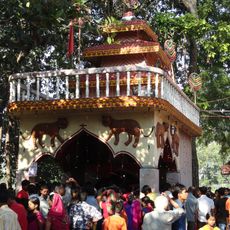
The local population speaks primarily Bhojpuri and celebrates seasonal festivals closely tied to agricultural cycles. Daily life here reflects traditions passed down through generations that remain visible in how people gather and mark important occasions.

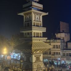
Motihari serves as the administrative center with essential services and facilities for visitors. Raxaul to the south provides convenient access and connections to neighboring Nepal.

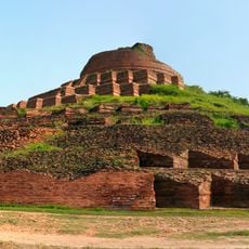
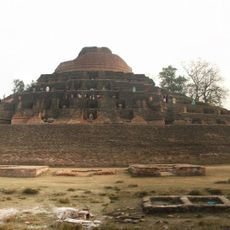
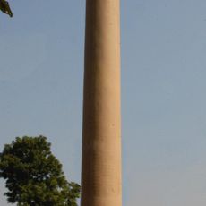
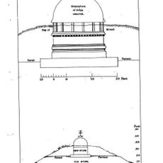
Kesariya contains an ancient Buddhist stupa that ranks among the tallest surviving structures of its kind from antiquity. The monument reflects the region's spiritual history, which has drawn believers across many centuries.

The community of curious travelers

AroundUs brings together thousands of curated places, local tips, and hidden gems, enriched daily by 60,000 contributors worldwide.

Start exploring
Location
Capital city
Motihari
Shares border with
West Champaran district
GPS coordinates
26.65000,84.91670
Latest update
December 17, 2025 10:15
« East Champaran District - Administrative district in Bihar, India » is provided by Around Us (aroundus.com). Images and texts are derived from Wikimedia project under a Creative Commons license. You are allowed to copy, distribute, and modify copies of this page, under the conditions set by the license, as long as this note is clearly visible.

Discover hidden gems everywhere you go!

From secret cafés to breathtaking viewpoints, skip the crowded tourist spots and find places that match your style. Our app makes it easy with voice search, smart filtering, route optimization, and insider tips from travelers worldwide. Download now for the complete mobile experience.

Around Us App Screenshot

A unique approach to discovering new places

Le Figaro

All the places worth exploring

France Info

A tailor-made excursion in just a few clicks

20 Minutes

Around Us
Travel Guide & Maps
Download

Send to your phone

QR Code
1

Open the camera app on your mobile.

2

Point at the QR code with your camera. A notification will appear.

3

Tap the notification to open the link.