Chitradurga district, Administrative district in Bengaluru division, India
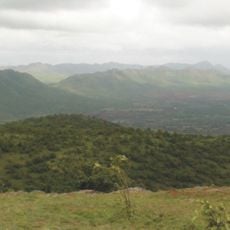
Chitradurga district spans across Karnataka with landscapes ranging from hills to plains, while the Vedavati River flows through its territory. The varied terrain supports different types of farming and settlement patterns across the region.
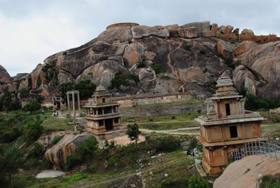
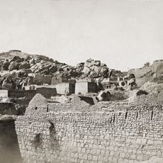
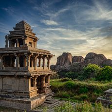
The region served as a military stronghold under the Kingdom of Mysore until independence in 1947, with its fortifications reflecting strategic importance across several dynasties. These defensive structures were built to control key trade routes and protect against invasions.
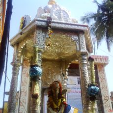
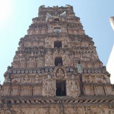
Kannada speakers form the majority here, and their traditions shape how local festivals unfold and how people gather for celebrations throughout the year. Religious customs are woven into daily routines and mark important moments in community life.
The region's economy relies on agriculture, with farmers growing millet, jowar, and pulses on the fertile lands scattered throughout. Plan your visit during farming seasons to see active fields and local markets where fresh produce is traded regularly.
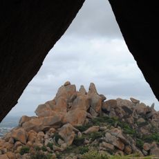
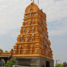
The name comes from an umbrella-shaped hill that local tradition links to ancient Indian epics Ramayana and Mahabharata. This distinctive landform has shaped settlement patterns and remains a recognizable landmark for residents throughout the region.
Location: Bangalore division
Capital city: Chitradurga
Shares border with: Davanagere district, Anantapuramu district
Website: http://chitradurga.nic.in
GPS coordinates: 14.00000,76.50000
Latest update: December 20, 2025 15:35
Chitradurga Fort
26.5 km
Chandravalli
26.3 km
Shri Guru Kottureshwara Temple
96.2 km
Jogimatti
21.2 kmRangayyanadurga Four–horned antelope Wildlife Sanctuary
72.4 km
Kaggaladu
43 kmBukkapatna Chinkara Wildlife Sanctuary
47.2 km
Teru Malleshvara Temple, Hiriyur
14.1 km
Chitradurga hill fortress & temples
26.5 km
Rayadurg Palace and Rama and Krishna temples
86.3 kmParvati & Kartikeya Temples
112.8 kmTemple group at Hemavati
53.6 kmRayadurg Hill Fort
86 kmVānīvilāsa Sāgara
15.3 kmBhīma Kere
89.4 kmAkka Tangi Temple & Ashokan Inscription Emmethammana Gundu
95.7 kmSculpture group at Hemavati
53.5 kmAshokan Inscription
96.4 kmPre-Historic Site
96.1 km
Malik Rihan Darga
53.1 kmRāni Kere
43.1 kmKarnataka Forest Department Mini Zoo Anagodu
64.2 kmLC 32, km 42/6
95.7 kmKM 45/2
93.9 kmSira Fort
53.1 kmRenuka Theatre
96.7 kmKalleshwara takies (closed)
31.9 kmRajeev Art Innovity
13.6 kmVisited this place? Tap the stars to rate it and share your experience / photos with the community! Try now! You can cancel it anytime.
Discover hidden gems everywhere you go!
From secret cafés to breathtaking viewpoints, skip the crowded tourist spots and find places that match your style. Our app makes it easy with voice search, smart filtering, route optimization, and insider tips from travelers worldwide. Download now for the complete mobile experience.
A unique approach to discovering new places❞
— Le Figaro
All the places worth exploring❞
— France Info
A tailor-made excursion in just a few clicks❞
— 20 Minutes