Amroha district, Administrative district in Uttar Pradesh, India
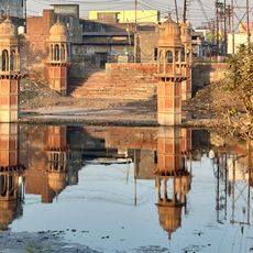
Amroha district sits in the fertile plains of Uttar Pradesh with the Ganges River marking its western edge. The area spreads across flat terrain bordered by neighboring districts including Bulandshahr, Hapur, and Meerut.
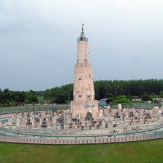
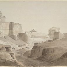
A significant battle took place here in 1305 when Alauddin Khilji defeated the Mongols in combat. The region later became part of the Mughal Empire and was organized under Mughal administration as Sambhal sarkar.
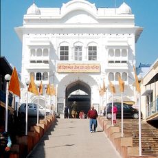
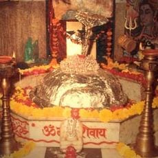
The people here speak Hindi and Urdu and gather throughout the year for religious festivals in temples and mosques. These places of worship serve as centers where the local community comes together to celebrate and maintain their daily traditions.
State Highways 72 and 73 link the area to larger cities, while the railway station on the Delhi-Moradabad line runs regular train services. Visitors can use public transport options to travel between towns and explore different parts of the district.
The area is known for growing mangoes on a large scale and producing handmade traditional percussion instruments called dholak. The textile, weaving, and pottery work done here reflect craft traditions that remain active in the present day.
Location: Moradabad division
Capital city: Amroha
Shares border with: Meerut district
Website: http://jpnagar.nic.in
GPS coordinates: 28.90000,78.47000
Latest update: December 13, 2025 13:44
Jambudweep
53.9 km
Hastinapur Sanctuary
46.7 km
Digamber Jain Bada Mandir Hastinapur
53.7 km
Moteshwar Mahadev
26.4 km
Bathing Ghat, Bulandshahr
80.7 km
Shahi Jama Masjid, Sambhal
36.7 km
Tomb of the grand son of Abdul Ghafur Shah and Mosque
32 km
Jami Masjid
36.8 km
Mosque of Karwan Sarai
41.8 km
Well or Baoli known as Bah-ka-Kuan
4.9 km
Talib Khan's Tomb
32.4 km
Chandesvara Khera
44 km
Tomb of Abdul Ghafur Shah
32.4 km
Tomb of Shah Peer
74.5 km
Gateway of Karwan Sarai
41.9 km
Old Fort and its relics
34.2 km
Ancient Mound
53.7 km
Mound
46.8 km
Khera or Mound reputed to be the ruin or a palace Raja Vena
55.8 km
Swargiya shreemati veena aggarwal smriti udyan
29.5 km
شیعہ مسجد اور قبرستان رام پور
54.3 km
Hotspot Mobile store
33.3 km
TATA Statue
68.4 km
Ambedkar ji statue
70.5 km
Statue, Work of art
71.2 km
Gandhi Samadhi
54.1 km
Kuchesar Mud Fortress
57 km
Overhead water tank
35 kmVisited this place? Tap the stars to rate it and share your experience / photos with the community! Try now! You can cancel it anytime.
Discover hidden gems everywhere you go!
From secret cafés to breathtaking viewpoints, skip the crowded tourist spots and find places that match your style. Our app makes it easy with voice search, smart filtering, route optimization, and insider tips from travelers worldwide. Download now for the complete mobile experience.
A unique approach to discovering new places❞
— Le Figaro
All the places worth exploring❞
— France Info
A tailor-made excursion in just a few clicks❞
— 20 Minutes