Enable Location

We need your location to show you interesting places around you

Discover nearby places

Find interesting locations and hidden gems around you

Precise directions

Get accurate directions and distances to places

Your location is never shared with other users. It's only used when you tap the location button.

Bidar district

Log in to your account

Start exploring — it's free

Trusted by 61,903 travelers worldwide

Continue with Google
Continue with Apple
or

We will send you a code to connect

By continuing, you accept our Terms and Conditions and our Privacy Policy

Check your inbox

We've sent a pincode in your inbox. Please enter the code below.

Bidar district, Administrative district in Kalaburagi division, India

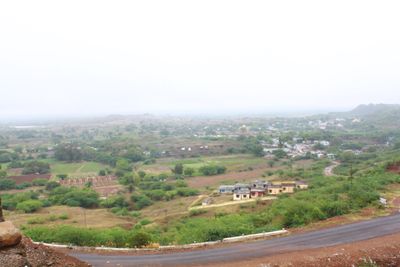
Bidar is an administrative district in Karnataka state situated at an elevation of around 615 meters, characterized by agricultural lands mixed with urban settlements. The terrain combines farming areas with urban centers that together define the district's landscape.

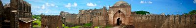
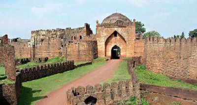
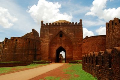
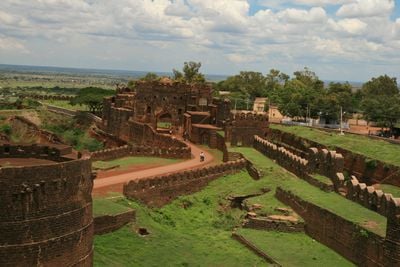
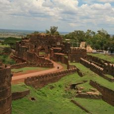
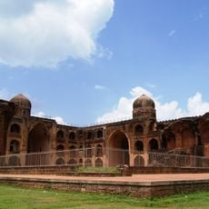
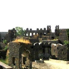
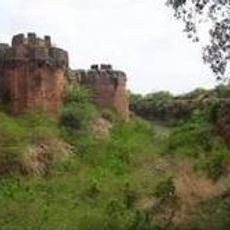
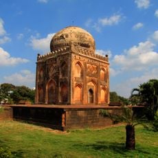
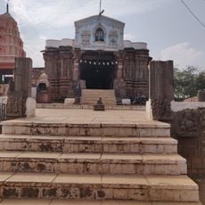
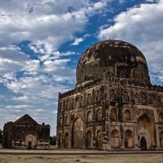
The district emerged as a center of power during the Bahmani Sultanate period when rulers established fortifications and administrative structures throughout the region. This era shaped the district's strategic importance for centuries to come.

Artisans throughout the district practice Bidriware craftsmanship, creating metal objects decorated with silver inlays using methods passed down through generations. This craft tradition shapes the character of local communities and remains central to their sense of identity.

The district connects to major cities via National Highway 9, with regular train services from Bidar railway station to Hyderabad and Bengaluru. Plan your journey around the local climate, as weather varies significantly across seasons.

An underground water system called Karez runs through the district, built in the 15th century using Persian engineering techniques to supply communities with water. This network demonstrates the advanced technical knowledge of that era.

The community of curious travelers

AroundUs brings together thousands of curated places, local tips, and hidden gems, enriched daily by 60,000 contributors worldwide.

Start exploring
Capital city
Bidar
Elevation above the sea
615 m
Shares border with
Latur district, Medak district
GPS coordinates
17.92000,77.51972
Latest update
December 17, 2025 08:13
« Bidar district - Administrative district in Kalaburagi division, India » is provided by Around Us (aroundus.com). Images and texts are derived from Wikimedia project under a Creative Commons license. You are allowed to copy, distribute, and modify copies of this page, under the conditions set by the license, as long as this note is clearly visible.

Discover hidden gems everywhere you go!

From secret cafés to breathtaking viewpoints, skip the crowded tourist spots and find places that match your style. Our app makes it easy with voice search, smart filtering, route optimization, and insider tips from travelers worldwide. Download now for the complete mobile experience.

Around Us App Screenshot

A unique approach to discovering new places

Le Figaro

All the places worth exploring

France Info

A tailor-made excursion in just a few clicks

20 Minutes

Around Us
Travel Guide & Maps
Download

Send to your phone

QR Code
1

Open the camera app on your mobile.

2

Point at the QR code with your camera. A notification will appear.

3

Tap the notification to open the link.