Harirampur community development block, Administrative division in Gangarampur subdivision, India
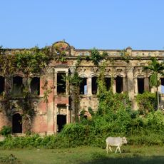
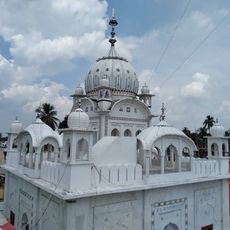
Harirampur is an administrative block in Gangarampur subdivision with mostly flat terrain and gentle undulations across its landscape. The area contains numerous villages, schools, and a rural hospital that serve the local population.
The block was established during the Community Development Programme of 1960, following the reorganization of West Dinajpur district after India's independence and partition. Its administrative structure reflects the changes that reshaped the region during that period.
The population of 136,853 residents includes a balanced mix of Hindu and Muslim communities, with Bengali and Santali as primary languages.
The area is dotted with villages and has basic services including a hospital and schools throughout the block. Visitors should expect rural infrastructure and transportation typical of agricultural regions.
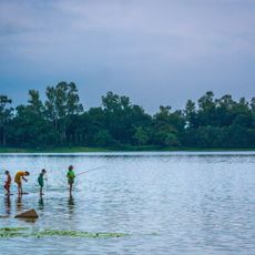
The local economy relies heavily on seasonal crops irrigated by water from ponds and groundwater sources. This water management system shapes the work rhythm and daily life throughout the region.
Location: Gangarampur subdivision
Shares border with: Itahar community development block, Gazole community development block, Bansihari community development block, Kushmandi community development block
GPS coordinates: 25.37425,88.26779
Latest update: December 12, 2025 07:59
Adina Mosque
26.8 km
Pandua
29.3 km
Eklakhi Mausoleum
28.6 km
Bangarh
26.8 km
Ramsagar National Park
39.4 km
Jagjivanpur
38.7 km
Adina Deer Park
27.7 km
Dargah of Shah Ata
26.7 km
Qutub Shahi Masjid
28.6 km
Bahin Zamindar bari
36.3 km
Pirpal Dargah
26.5 km
Mandirbasini temple
25.8 km
Poragachhi temple
25.9 km
Mohanta masjid
28.2 km
Durgadalan of Bhupalpur Rajbari
21.7 km
Bhupalpur Rajbari
21.7 km
Mahurkismat Pancharatna temple
28.9 km
Gurdwara Nima Serai Sri Guru Tegh Bahadur
39 km
Pirpukurer Dargah
30 km
Bhaior Mata temple
25 km
Panchamukhi Shiva Temple
14.7 km
Thakurdalan of Zamindar house of Bandopadhyay family
25.8 km
Pramatheshwar Mahadevjiu temple
13.3 km
Kardaha Shiva temple
23.5 km
Zamindar house of Bandopadhyay family
25.9 km
Shibbari solitary pillar
27.4 km
Site of Usha and Aniruddha's Marriage
27.4 km
Mahipaldighi Neelkuthi
27.2 kmVisited this place? Tap the stars to rate it and share your experience / photos with the community! Try now! You can cancel it anytime.
Discover hidden gems everywhere you go!
From secret cafés to breathtaking viewpoints, skip the crowded tourist spots and find places that match your style. Our app makes it easy with voice search, smart filtering, route optimization, and insider tips from travelers worldwide. Download now for the complete mobile experience.
A unique approach to discovering new places❞
— Le Figaro
All the places worth exploring❞
— France Info
A tailor-made excursion in just a few clicks❞
— 20 Minutes