Langjökull

Log in to your account

AroundUs is a community-driven map of interesting places, built by curious explorers like you. It grows with every review, story, and photo you share.
Connect to save your favorite spots, contribute locations, and create personalized routes.
By continuing, you accept our Terms and Conditions and our Privacy Policy

Langjökull

Add to collection
Map
Suggest a change
Share

Langjökull, Ice cap in Southern Region, Iceland

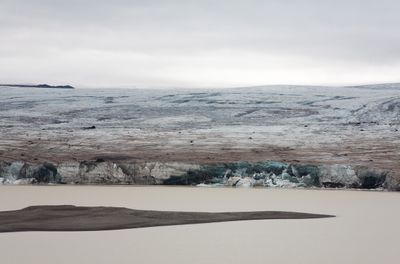
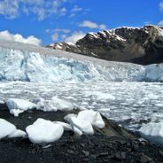
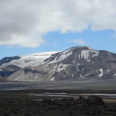
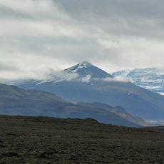
Langjökull is the second-largest ice cap in Iceland and spreads across the southern and western regions with a length of about 50 kilometers and a width of 20 kilometers. The surface shows a rolling profile with crevasses and ice fields, while underneath lie two volcanic systems and ancient lava fields.

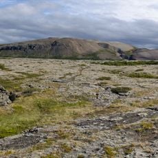
The lava field Kjalhraun beneath the ice cap formed about 7800 years ago through volcanic activity. The ice cap began forming over it in later centuries and remains today above two active volcanic systems.

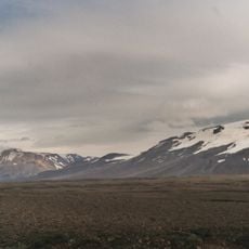
The name means Long Ice in Icelandic and describes its shape stretching through the western highlands. Visitors today see a white expanse spreading between volcanic peaks and crossed by crevasses.

Guided tours depart from Húsafell Center or Klaki and offer activities such as snowmobile rides and ice cave visits. The highland area requires proper winter gear and is best visited with an experienced local guide.

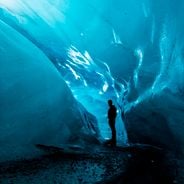
An engineered ice tunnel was carved into the cap and is the largest of its kind worldwide. Visitors can walk inside and observe the layered ice sheets that formed over centuries.

Location: Southern Region

Location: Western Region

Part of: Silver Circle

GPS coordinates: 64.69186,-20.19684

Latest update: December 5, 2025 22:28

Photos
Glaciers worldwide: Perito Moreno, Jostedalsbreen, Vatnajökull

Glaciers represent some of the most remarkable natural formations on Earth. These ice masses form over centuries through the compression of snow and move slowly through valleys and across mountain slopes. They shape landscapes from the Patagonian Andes to Arctic regions and store approximately 70...

The Best Spots in Iceland and Reykjavik

Iceland is an island shaped by ice and fire. Glaciers cover much of the interior while geothermal areas show that something is always happening beneath the surface. The landscapes here look different from most places: black sand beaches formed by volcanic activity, fjords cutting deep into the...

Reviews

Visited this place? Tap the stars to rate it and share your experience / photos with the community! Try now! You can cancel it anytime.

« Langjökull - Ice cap in Southern Region, Iceland » is provided by Around Us (aroundus.com). Images and texts are derived from Wikimedia project under a Creative Commons license. You are allowed to copy, distribute, and modify copies of this page, under the conditions set by the license, as long as this note is clearly visible.

Discover hidden gems everywhere you go!

From secret cafés to breathtaking viewpoints, skip the crowded tourist spots and find places that match your style. Our app makes it easy with voice search, smart filtering, route optimization, and insider tips from travelers worldwide. Download now for the complete mobile experience.

Around Us App Screenshot

A unique approach to discovering new places

Le Figaro

All the places worth exploring

France Info

A tailor-made excursion in just a few clicks

20 Minutes