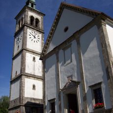
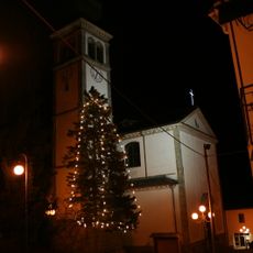
Paluzza, Italian comune
Location: ente di decentramento regionale di Udine
Capital city: Paluzza
Elevation above the sea: 605 m
Shares border with: Cercivento, Forni Avoltri, Paularo, Rigolato, Treppo Ligosullo, Arta Terme, Comeglians, Sutrio, Ravascletto, Kötschach-Mauthen, Lesachtal
Website: http://comune.paluzza.ud.it
GPS coordinates: 46.53081,13.01821
Latest update: March 3, 2025 16:17
Monte Zoncolan
7.7 km
Monte Cogliàns
13.4 km
Eiskar Glacier
12.3 km
Kellerspitzen
12.6 km
Frischenkofel
11 km
Creta di Timau
7.4 km
Monte Tamai
7.7 km
Ossuary Timau
6.4 km
Monte Arvènis
8.3 km
Gailtaler Polinik
11.1 km
Frondell Alm
10.1 km
Zollner Peace Chapel
9.2 km
Santa Maria
27 m
Kollinkofel
12.1 km
Chiesa di Ognissanti
3.4 km
San Martino Vescovo
2.4 km
Chiesa di Santo Stefano Protomartire
4.8 km
Chiesa dello Spirito Santo
5.4 km
Chiesa di San Matteo Apostolo
7.8 km
Sant'Agnese
1.9 km
Museo della Grande Guerra Timau / Kriegsmuseum Tischelwang
5.9 km
Blaustein
8 km
Open-air museum Freikofel
8.4 km
Laucheck
10.3 km
Torre Moscarda
191 m
Presepio di Teno
3.1 km
Köderhöhe
9.3 km
Kriegergedächtniskapelle Plöcken
10.6 kmReviews
Visited this place? Tap the stars to rate it and share your experience / photos with the community! Try now! You can cancel it anytime.
Discover hidden gems everywhere you go!
From secret cafés to breathtaking viewpoints, skip the crowded tourist spots and find places that match your style. Our app makes it easy with voice search, smart filtering, route optimization, and insider tips from travelers worldwide. Download now for the complete mobile experience.
A unique approach to discovering new places❞
— Le Figaro
All the places worth exploring❞
— France Info
A tailor-made excursion in just a few clicks❞
— 20 Minutes