Enable Location

We need your location to show you interesting places around you

Discover nearby places

Find interesting locations and hidden gems around you

Precise directions

Get accurate directions and distances to places

Your location is never shared with other users. It's only used when you tap the location button.

Sauris

Log in to your account

Start exploring — it's free

Trusted by 61,426 travelers worldwide

Continue with Google
Continue with Apple
or

We will send you a code to connect

By continuing, you accept our Terms and Conditions and our Privacy Policy

Check your inbox

We've sent a pincode in your inbox. Please enter the code below.

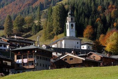
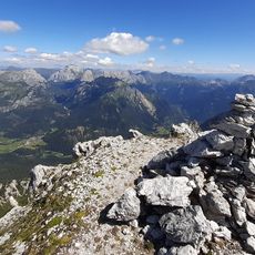
Sauris, Mountain commune in Friuli-Venezia Giulia, Italy

Description

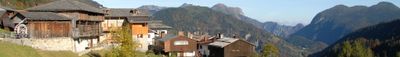
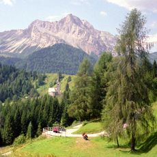
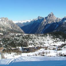
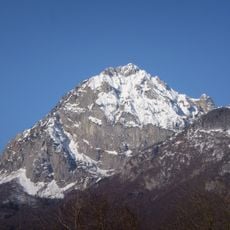
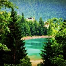
Sauris is a mountain commune in the Carnic Alps, located in the Lumiei Valley at about 1,200 meters elevation, where two main villages form a small, closely-knit settlement. A reservoir fills the valley and shapes the surrounding landscape.

History

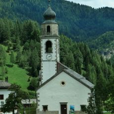
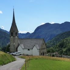
The settlement began around 1300 when German farmers from the Hochpustertal and Lesachtal regions established themselves in this isolated mountain valley. This origin makes it a remnant of medieval Alpine settlement.

Culture

Residents speak Saurano, a local dialect with German roots that has survived for centuries and shapes daily conversations. This language variety connects the community to its distant medieval past and remains an important part of local identity.

Practical

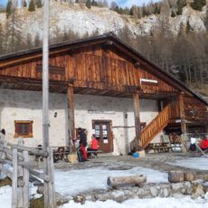
The place was accessible only on foot until 1934, when the first road was built over the mountains to Ampezzo, changing how people could reach it. Today it remains a quiet destination suited for exploring the mountain landscape at your own pace.

Did you know?

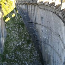
A dam was built between 1941 and 1948 in the valley, creating a reservoir that fundamentally changed the landscape. This reservoir now defines the appearance of the area and stands as a defining feature of the place.

Elevation above the sea
1,212 m
Shares border with
Forni di Sotto, Ovaro, Prato Carnico, Vigo di Cadore, Forni di Sopra, Ampezzo
GPS coordinates
46.46537,12.70872
Latest update
December 20, 2025 00:25

AroundUs brings together thousands of curated places, local tips, and hidden gems, enriched daily by 60,000 contributors worldwide. Discover all places nearby (regional decentralization entity of Udine).

« Sauris - Mountain commune in Friuli-Venezia Giulia, Italy » is provided by Around Us (aroundus.com). Images and texts are derived from Wikimedia project under a Creative Commons license. You are allowed to copy, distribute, and modify copies of this page, under the conditions set by the license, as long as this note is clearly visible.

Discover hidden gems everywhere you go!

From secret cafés to breathtaking viewpoints, skip the crowded tourist spots and find places that match your style. Our app makes it easy with voice search, smart filtering, route optimization, and insider tips from travelers worldwide. Download now for the complete mobile experience.

Around Us App Screenshot

A unique approach to discovering new places

Le Figaro

All the places worth exploring

France Info

A tailor-made excursion in just a few clicks

20 Minutes

Around Us
Travel Guide & Maps
Download

Send to your phone

QR Code
1

Open the camera app on your mobile.

2

Point at the QR code with your camera. A notification will appear.

3

Tap the notification to open the link.