Tharros, Archaeological site in Cabras, Italy
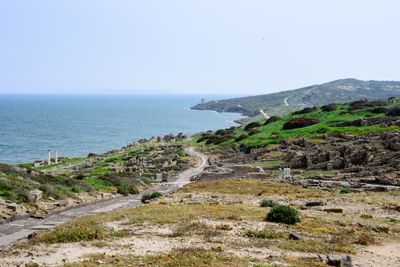
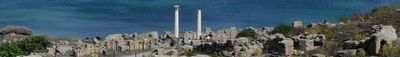
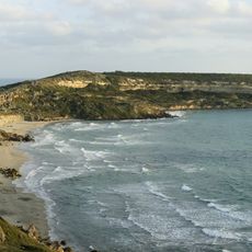
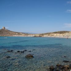
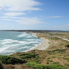
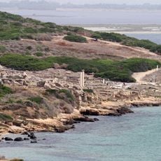
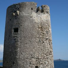
Tharros is an archaeological site in Cabras on the western coast of Sardinia, occupying a rocky peninsula overlooking the Gulf of Oristano. The sprawling remains include paved streets with deep ruts, residential structures of cut stone, and foundations of several public buildings arranged on a hillside facing the sea.
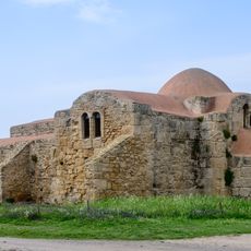
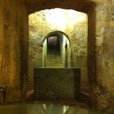
Phoenician traders established a settlement on the peninsula in the 8th century BC, using its sheltered position for maritime commerce. The town grew under Punic rule and was later taken by Rome, which added new infrastructure such as baths and a forum.
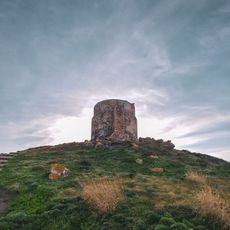
The multiple burial grounds show different funerary practices, including stone chamber tombs and open cremation sites, revealing the religious rituals of diverse communities. Visitors can explore the preserved outlines of sacred precincts where residents performed their ceremonies and offerings.
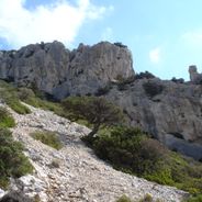
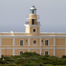
The site opens daily from 9:00 AM to 8:00 PM and offers pathways that wind through the different excavation zones. Wear sturdy shoes as the surfaces are rocky and uneven, and expect strong winds from the sea.
Analysis of skeletons from the southern burial ground showed individuals from North Africa and the Iberian Peninsula were interred here, revealing the far-reaching trade links of the ancient port. The diverse origins reflect the Mediterranean mobility of its inhabitants across centuries.
Location: Cabras
Opening Hours: 9:00-20:00
Phone: +390783370019
Email: info@penisoladelsinis.it
Website: http://penisoladelsinis.it
GPS coordinates: 39.87344,8.44102
Latest update: December 5, 2025 22:26
Sardinia preserves traces of human settlement across thousands of years. The island presents prehistoric cult sites including sacred wells and burial mounds that show ancient rituals. Nuraghe towers from the Bronze Age still rise above the landscape, while Roman theaters and Punic temples mark later civilizations. Underground tombs carved directly into rock lie hidden in the hills. Mountain villages carry modern wall murals that tell political and social history. The coastline offers small coves with turquoise water and white pebble beaches between limestone cliffs. Caves along the coast display stalactites and underground lakes. Inland, canyons with tall rock walls cut through remote areas. Natural springs emerge from bedrock, lighthouses stand on headlands overlooking the sea. Abandoned mining complexes document industrial history, while protected islands and coastal reserves provide habitat for marine life and seabirds.
Giants of Mont'e Prama
10.3 km
Is Arutas beach
9.3 km
Capo San Marco
1.5 km
San Giovanni di Sinis
1 km
Area marina protetta Penisola del Sinis - Isola Mal di Ventre
4.4 km
Museo Civico Giovanni Marongiu
9.2 km
San Salvatore
5.3 km
Capo San Marco Lighthouse
1.6 km
Torre Grande Lighthouse
7.4 km
Spiaggia di Mare morto
755 m
Maria Assunta
9.7 km
Tower of Capo San Marco
857 m
Tower of Su Pottu
8 km
Scaiu Ecciu
9.6 km
Santa Maria Stella Maris
7.6 km
Spiaggia di Maimoni
5.5 km
Santo Spirito
10 km
Spiaggia di Torregrande
7.4 km
Spiaggia del Pontile
8.3 km
S'Ungroni 'e Sa Palla
8.5 km
Su Bardoni
10 km
Torre di San Giovanni
182 m
Spiaggia Is Arutas
9.3 km
Beach of San Giovanni di Sinis
887 m
Tharros amphitheatre
397 m
Torre di Seu
4.2 km
Ponds in the Bay of Oristano and the Sinis Peninsula island of Mal di Ventre
10.1 km
Town hall of Cabras
10 kmReviews
Visited this place? Tap the stars to rate it and share your experience / photos with the community! Try now! You can cancel it anytime.
Discover hidden gems everywhere you go!
From secret cafés to breathtaking viewpoints, skip the crowded tourist spots and find places that match your style. Our app makes it easy with voice search, smart filtering, route optimization, and insider tips from travelers worldwide. Download now for the complete mobile experience.
A unique approach to discovering new places❞
— Le Figaro
All the places worth exploring❞
— France Info
A tailor-made excursion in just a few clicks❞
— 20 Minutes