Mount Arcuentu, Volcanic summit in southwestern Sardinia, Italy
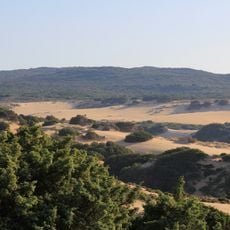
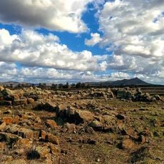
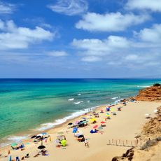
Mount Arcuentu is a volcanic massif in southwestern Sardinia, northwest of Guspini, reaching 785 m (2,575 ft). Its crest runs for about 8 km parallel to the Costa Verde coastline. The rock is volcanic, with rhyolites, rhyodacites, ignimbrites and tuffs alongside basalts, formed between the Oligocene and Miocene. From the top you can see the Sinis peninsula, the Giara, Monte Arci, the Gulf of Oristano and the Campidano plain.
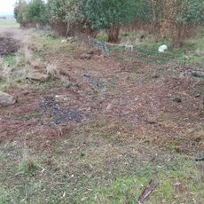
The sources document no castle on the summit; the mountain's recorded history is geological, formed by Oligocene and Miocene volcanic activity that produced rhyolites, rhyodacites, ignimbrites, tuffs and basalts. In August 2011 a large fire swept the Costa Verde coast and the mountains around Arbus and Guspini, burning the woodland on the slopes below the massif.
The name joins the Sardinian words árcu (curved, bow-shaped) and 'entu or bentu (wind), giving "Arch of the Wind", as linguist Massimo Pittau translated it. A local variant, Erculentu, also names the plant known as abrotano. The first element refers to the arched profile of the summit rocks.
The summit is reached by trail 192 of the Club Alpino Italiano, which starts at the Montevecchio mines. The route climbs the volcanic slopes of the massif; the sources give no other access point. Streams on the flanks are torrential and carry water mainly after rain.
The summit holds a centuries-old holm oak wood, and the slopes carry four Sardinian broom species (Genista corsica, morisii, sulcitana, valsecchiae) plus the endemic Sardinian carnation and Sardinian cabbage. A 2011 fire burned the woodland on the lower slopes of the massif.
The community of curious travelers
AroundUs brings together thousands of curated places, local tips, and hidden gems, enriched daily by 94,368 contributors worldwide.