Chest opened
+${chestReward.xp} XP
Explorer
NOUVEAU ×${chestReward.collectible.quantity}
tapez pour fermer

See the monuments around you in AR Open chests in the app

Around Us is built for your phone — point your camera at the streets and discover the monuments and places around you in augmented reality. Around Us is built for your phone — chests unlock when you walk, explore and capture nearby places.

•

Enable Location

We need your location to show you interesting places around you

Discover nearby places

Find interesting locations and hidden gems around you

Precise directions

Get accurate directions and distances to places

Your location is never shared with other users. It's only used when you tap the location button.

Monte Ponteranica

Log in to your account

Start exploring — it's free

Trusted by 94,663 travelers worldwide

Continue with Google
Continue with Apple
or

We will send you a code to connect

By continuing, you accept our Terms and Conditions and our Privacy Policy

Check your inbox

We've sent a pincode in your inbox. Please enter the code below.

Monte Ponteranica

Monte Ponteranica, Mountain summit in Lombardy, Italy

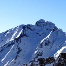
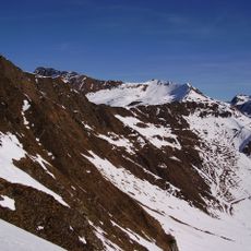
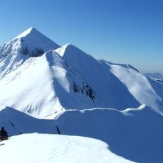
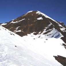
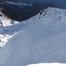
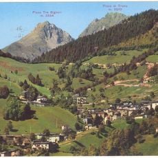
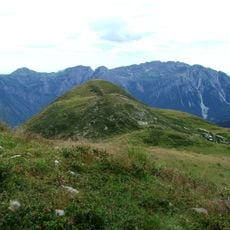
Monte Ponteranica is a 2,378 m summit on the Orobie Alps watershed between Val Brembana and Val Gerola. Its top runs along several peaks: Monte Valletto lies west along the ridge, while the eastern side drops toward Passo San Marco. Two small alpine lakes, the Laghetti di Ponteranica, sit below the western summit.

The mountain's name comes from an old alpine pasture of about 150 hectares in Santa Brigida, bought by the commune of Ponteranica from the Valle Averara community in the late 16th century to secure summer grazing. Each late June, families of Ponteranica paid fees to entrust cows and sheep to commune agents, who kept them on the heights until late August; the cheese and wool were then divided among owners by the number of animals sent.

For centuries, local herders have grazed livestock on the broad alpine pastures when weather permits. This seasonal practice remains visible in the landscape today and shapes how people interact with the mountain throughout the year.

The shortest route starts from the Piani dell'Avaro, reached by a narrow asphalt road from Cusio. From there, head north toward Monte Avaro and take the right-hand path near the concrete water intake building, then join trail 101 past Monte Triomen to the Ponteranica lakes; the path to the western summit rises behind the lakes. From Cà San Marco, trail 101 leads toward the Verrobbio pass in about 50 minutes, then on toward Monte Colombarolo and along the ridge to the eastern summit.

A long southern ridge connects this peak to Monte Colombarolo, passing through natural water pools and varied rock formations. This ridge traverse offers an unusual way to link two separate mountain areas while crossing open terrain.

The community of curious travelers

AroundUs brings together thousands of curated places, local tips, and hidden gems, enriched daily by 94,663 contributors worldwide.

Start exploring
Location
Elevation above the sea
2,378 m
GPS coordinates
46.02913,9.59533
Latest update
October 25, 2026 20:38
Reviews
Share your experience

No review yet

Discussions
Start a discussion...

No discussion yet

« Monte Ponteranica - Mountain summit in Lombardy, Italy » is provided by Around Us (aroundus.com). Images and texts are derived from Wikimedia project under a Creative Commons license. You are allowed to copy, distribute, and modify copies of this page, under the conditions set by the license, as long as this note is clearly visible.

Discover hidden gems everywhere you go!

From secret cafés to breathtaking viewpoints, skip the crowded tourist spots and find places that match your style. Our app makes it easy with voice search, smart filtering, route optimization, and insider tips from travelers worldwide. Download now for the complete mobile experience.
Around Us App Screenshot
❝

A unique approach to discovering new places❞

— Le Figaro

❝

All the places worth exploring❞

— France Info

❝

A tailor-made excursion in just a few clicks❞

— 20 Minutes

Around Us
Travel Guide & Maps
Download

Send to your phone

QR Code
1

Open the camera app on your mobile.

2

Point at the QR code with your camera. A notification will appear.

3

Tap the notification to open the link.