Enable Location

We need your location to show you interesting places around you

Discover nearby places

Find interesting locations and hidden gems around you

Precise directions

Get accurate directions and distances to places

Your location is never shared with other users. It's only used when you tap the location button.

Kyonan

Log in to your account

Start exploring — it's free

Trusted by 61,909 travelers worldwide

Continue with Google
Continue with Apple
or

We will send you a code to connect

By continuing, you accept our Terms and Conditions and our Privacy Policy

Check your inbox

We've sent a pincode in your inbox. Please enter the code below.

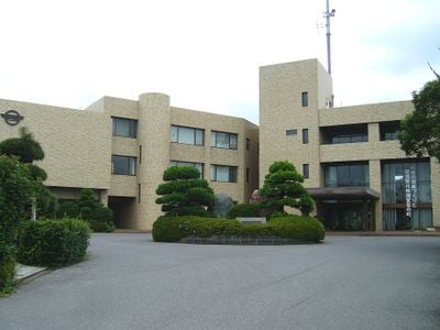
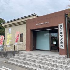
Kyonan, Administrative town in Awa district, Chiba Prefecture, Japan

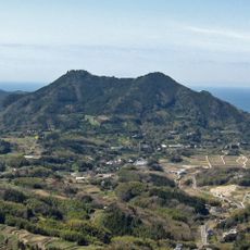
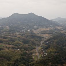
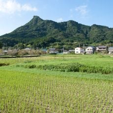
Kyonan is a town in Awa district located on the Boso Peninsula, where mountains rise inland while a coastline borders Tokyo Bay. The terrain varies from elevated areas in the interior to lower lands meeting the shore.

The town formed in 1959 when two separate communities merged into a single administrative area. This consolidation brought together different territories under one governance structure.

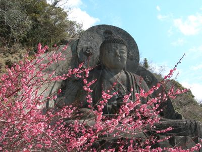
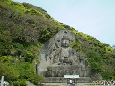
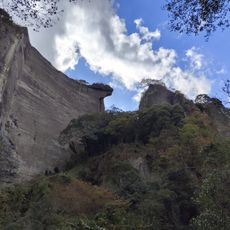
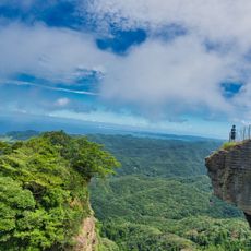
The town's name draws from Mount Nokogiri, whose distinctive saw-like profile shapes how locals see and navigate their surroundings. This geographical feature remains central to how people here connect with their environment.

The town is accessible via the JR East Uchiho Line, which serves as the primary transportation route through the area. Visitors should know that facilities are limited and the surroundings maintain a rural character.

The area has cultivated narcissus flowers since the Edo period and ranks among Japan's leading producers of these blooms. This horticultural heritage remains woven into the local economy and identity.

The community of curious travelers

AroundUs brings together thousands of curated places, local tips, and hidden gems, enriched daily by 60,000 contributors worldwide.

Start exploring
Location
Inception
March 30, 1959
Reference
124630
Part of
Tateyama metropolitan area
Shares border with
Kamogawa, Futtsu, Minamiboso
GPS coordinates
35.11111,139.83578
Latest update
December 17, 2025 08:52
« Kyonan - Administrative town in Awa district, Chiba Prefecture, Japan » is provided by Around Us (aroundus.com). Images and texts are derived from Wikimedia project under a Creative Commons license. You are allowed to copy, distribute, and modify copies of this page, under the conditions set by the license, as long as this note is clearly visible.

Discover hidden gems everywhere you go!

From secret cafés to breathtaking viewpoints, skip the crowded tourist spots and find places that match your style. Our app makes it easy with voice search, smart filtering, route optimization, and insider tips from travelers worldwide. Download now for the complete mobile experience.

Around Us App Screenshot

A unique approach to discovering new places

Le Figaro

All the places worth exploring

France Info

A tailor-made excursion in just a few clicks

20 Minutes

Around Us
Travel Guide & Maps
Download

Send to your phone

QR Code
1

Open the camera app on your mobile.

2

Point at the QR code with your camera. A notification will appear.

3

Tap the notification to open the link.