Chest opened
+${chestReward.xp} XP
Explorer
NOUVEAU ×${chestReward.collectible.quantity}
tapez pour fermer

See the monuments around you in AR Open chests in the app

Around Us is built for your phone — point your camera at the streets and discover the monuments and places around you in augmented reality. Around Us is built for your phone — chests unlock when you walk, explore and capture nearby places.

•

Enable Location

We need your location to show you interesting places around you

Discover nearby places

Find interesting locations and hidden gems around you

Precise directions

Get accurate directions and distances to places

Your location is never shared with other users. It's only used when you tap the location button.

Mount Naeba

Log in to your account

Start exploring — it's free

Trusted by 93,182 travelers worldwide

Continue with Google
Continue with Apple
or

We will send you a code to connect

By continuing, you accept our Terms and Conditions and our Privacy Policy

Check your inbox

We've sent a pincode in your inbox. Please enter the code below.

Mount Naeba

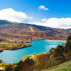
Mount Naeba, Stratovolcano on the Nagano–Niigata border, Japan

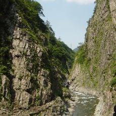
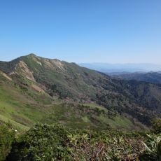
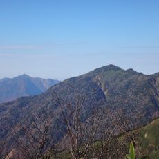
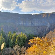
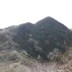
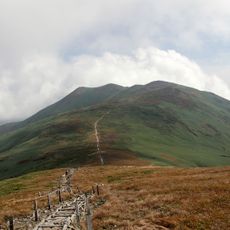
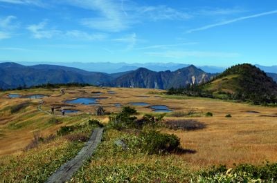
Mount Naeba is a stratovolcano on the Niigata–Nagano border built mainly of andesite lava and pyroclastic rock. Its summit is a gently sloping lava plateau of about 600 hectares, edged by cliffs cut by the Nakatsu and Kiyotsu rivers, giving it a table-mountain profile. The plateau holds high moorland with ponds where plants grow like rice seedlings, and the northern ridge includes Kaguraga-mine and Kirinoto.

Mount Naeba is a stratovolcano of andesite lava and pyroclastic rock that erupted in four major phases; its present edifice formed about 300,000 years ago. The summit plateau, a lava tableland of roughly 600 hectares, lies within Jōshin'etsu Kōgen National Park. In 1811 the merchant and writer Suzuki Bokushi climbed it and described it in his book Hokuetsu Seppu.

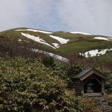
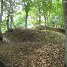
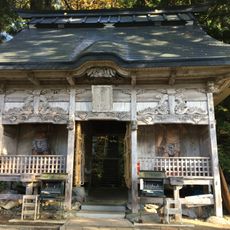
The summit plateau holds the Ime and Naeba shrines, stone Buddhas and small stone towers, and was long venerated as a guardian of rice farming. The name may come from the pond vegetation resembling rice seedlings (nae). The Ime shrine's festival at Mitsumata falls on 12 July, with the mountain opening in the first week of July.

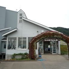
The main Niigata-side trail starts from the Mitsumata area of Kagura Ski Resort, where a parking lot sits below the fifth station; no bus serves the trailhead, so access is by taxi or private car. The fifth station has the Wada Hut with baths and toilets. Snow can linger near the summit until summer, and many junctions make route-finding tricky.

The summit plateau, about 600 hectares, holds a high moor with ponds where sedges and Miyama-hotasai grow like rice seedlings, giving the mountain its name. The Dragondola cable car links the Naeba ski resort to the Kagura ski area, not the summit.

The community of curious travelers

AroundUs brings together thousands of curated places, local tips, and hidden gems, enriched daily by 93,182 contributors worldwide.

Start exploring
Location
Location
Location
Elevation above the sea
2,145 m
Made from material
andesite
Part of
100 Famous Japanese Mountains
GPS coordinates
36.84583,138.69028
Latest update
October 29, 2026 09:37
Reviews
Share your experience

No review yet

Discussions
Start a discussion...

No discussion yet

« Mount Naeba - Stratovolcano on the Nagano–Niigata border, Japan » is provided by Around Us (aroundus.com). Images and texts are derived from Wikimedia project under a Creative Commons license. You are allowed to copy, distribute, and modify copies of this page, under the conditions set by the license, as long as this note is clearly visible.

Discover hidden gems everywhere you go!

From secret cafés to breathtaking viewpoints, skip the crowded tourist spots and find places that match your style. Our app makes it easy with voice search, smart filtering, route optimization, and insider tips from travelers worldwide. Download now for the complete mobile experience.

Around Us App Screenshot
❝

A unique approach to discovering new places❞

— Le Figaro

❝

All the places worth exploring❞

— France Info

❝

A tailor-made excursion in just a few clicks❞

— 20 Minutes

Around Us
Travel Guide & Maps
Download

Send to your phone

QR Code
1

Open the camera app on your mobile.

2

Point at the QR code with your camera. A notification will appear.

3

Tap the notification to open the link.